
Other basemap providers
Besides the built-in Icon Map styles, the basemap can come from ArcGIS, Azure Maps, Mappable, Ordnance Survey, any tile server, a style document that you host, or a WMS service. This page says what each one offers and what it needs.
At a glance
| Provider | Kind | What you need | Label language |
|---|---|---|---|
| ArcGIS | Vector styles, tiled services, web maps | An ArcGIS API key or another ArcGIS connection for Esri's basemap styles. Public services need none | Yes |
| Azure Maps | Raster tiles | An Azure Maps key | Yes |
| Mappable | Raster tiles | A Mappable key | See below |
| Ordnance Survey | Raster or vector tiles, Great Britain | An OS Data Hub key | No |
| Raster Tiles | Raster tiles from any XYZ server | A tile template link | No |
| Vector Tiles | A MapLibre style document | A style link | No |
| WMS | Map images from a WMS service | The service address | No |
| None | No basemap | Nothing |
Where you set a provider up depends on the map. Maps that use the Basemaps dialog add a provider with + Add a basemap and set its options on the list entry. Maps that use the Format pane choose it in Background Layer > Map Source > Background map source. Basemaps overview explains which your map uses. The pane's settings are listed in full in Set the basemap in the Format pane. The dialog's options are listed on this page.
In the Basemaps dialog, Raster Tiles is called Tile server, Vector Tiles is called MapLibre style, and None is replaced by Blank, which has a color.
Google Maps, Mapbox, MapTiler and single-image backgrounds are part of the Legacy engine. See the documentation for 1.1.0.9 and earlier. A MapTiler style can still be used on the Modern engine by giving its style link, key included, as a Vector Tiles basemap.
Keys and credentials
Keys are entered once, on the API Keys & Authentication card of the Format pane, and are saved in the report:
- API Keys > Azure Maps
- API Keys > Mappable
- API Keys > Ordnance Survey
- ArcGIS Authentication for ArcGIS
In the Basemaps dialog you can paste the Azure Maps, Mappable or Ordnance Survey key on the provider's form. It is saved to the same place when you select Apply changes.
The card, the ArcGIS connection types and the Icon Map proxy are described in API keys, authentication and the proxy and Connect to ArcGIS.
ArcGIS
ArcGIS basemaps come from ArcGIS Online or your own ArcGIS Enterprise portal.
| Source | What it draws |
|---|---|
| ArcGIS style | One of Esri's basemap styles: Outdoor, Community, Navigation, Streets, Streets (relief), Imagery, Oceans, Topographic, Light Gray, Dark Gray, Human Geography, Charted Territory or Nova |
| OpenStreetMap style | OpenStreetMap data styled by Esri: Standard, Navigation, Streets or Blueprint |
| Custom style | A vector basemap style of your own, by item ID |
| Tiled service | A tiled map service, for example https://server/arcgis/rest/services/World_Imagery/MapServer |
The ArcGIS and OpenStreetMap styles can show place names in a chosen language. The default, Global, uses the style's own names.
A tiled service must have Web Mercator tiles. The map shows "Powered by Esri" and, for the basemap styles, the data contributors for the current view.
New in 1.1.0.11 A fifth source, Web map, draws the basemap layers of an ArcGIS web map. Its other layers can be added as an ArcGIS reference layer. See ArcGIS layers. A web map with public layers needs no credential.
With API Key authentication, only Esri's basemap styles need the key: ArcGIS style, OpenStreetMap style and a Custom style given by item ID. A public tiled service such as World Imagery, a custom style given by its URL and a web map with public layers load without a key. A secured tiled service with no key shows "Please enter an ArcGIS API Key in the formatting settings."
In the Basemaps dialog, the ArcGIS form has these options:
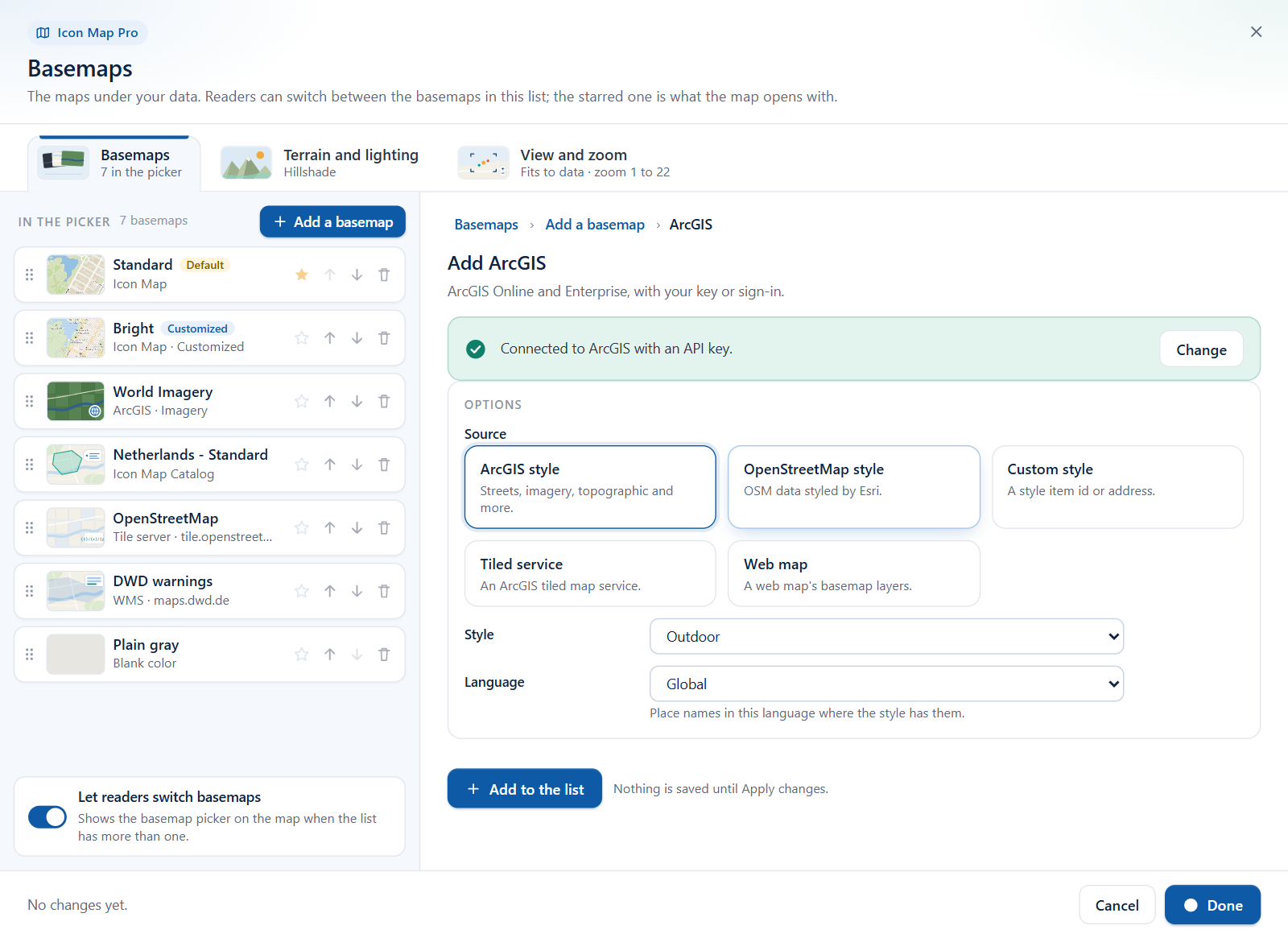
| Option | What it does | Default |
|---|---|---|
| Source | ArcGIS style, OpenStreetMap style, Custom style, Tiled service or Web map | ArcGIS style |
| Style | The style, for the first two sources | Outdoor / Standard |
| Language | Place names in this language where the style has them. Global or one of 11 languages | Global |
| Style item id or address | For Custom style: the item ID of a vector basemap style, or its style URL | Empty |
| Tiled service address | For Tiled service: a MapServer with Web Mercator tiles | Empty |
| Web map item id | For Web map | Empty |
| Browse ArcGIS for a web map | For Web map: closes the dialog, opens Browse ArcGIS, and reopens with your choice |
The Format pane's Language list for ArcGIS is longer: Global and 40 languages.
Azure Maps
Microsoft's Azure Maps, drawn as raster tiles.
| Choice | Options |
|---|---|
| Style | Road, Dark Gray or Imagery |
| Labels over imagery | None, Roads, Boundaries and Labels, or Labels only |
| Hill shading | Microsoft's shaded relief over the Road style |
| Language | The language of labels. Default: English (USA) |
The Format pane also offers Authentication Method: Azure Maps Key (the default) or Azure AD with a client ID.
In the Basemaps dialog the options are Style, Labels, Hillshade and Language. Language is a text box that takes an Azure Maps language code, for example de-DE. The default is en-US. The dialog needs an Azure Maps key.
Mappable
Mappable, drawn as raster tiles. Choose Map or Driving in Map type. You can get a key at mappable.world.
In the Basemaps dialog, a Mappable basemap also has a Language text box that takes a Mappable language code, for example en_US or ar_AE. The default is en_US. Maps that use the Format pane draw Mappable in English.
Ordnance Survey
Maps of Great Britain from the OS Data Hub. Styles: Road, Outdoor, Light and Vector Tiles.
- The Modern engine draws Ordnance Survey in Web Mercator. The British National Grid projection (EPSG:27700) is part of the Legacy engine.
- The raster styles (Road, Outdoor, Light) are available from zoom 7 to zoom 20.
- The Leisure style is not supported.
- The OS logo and a Crown copyright credit are shown on the map.
Raster Tiles
Any tile server that serves XYZ tiles. Give the tile template, for example:
https://tile.example.com/{z}/{x}/{y}.png
| Token | Meaning |
|---|---|
{z}, {x}, {y} |
Filled in by the map for each tile |
{s} |
Spread across the subdomains a, b and c |
{-y} |
The server numbers rows from the bottom (TMS) |
The link must start with https://. WMTS links are not accepted for the basemap. To draw a WMTS service, add it as a reference layer. See Raster tiles, WMTS and WMS.
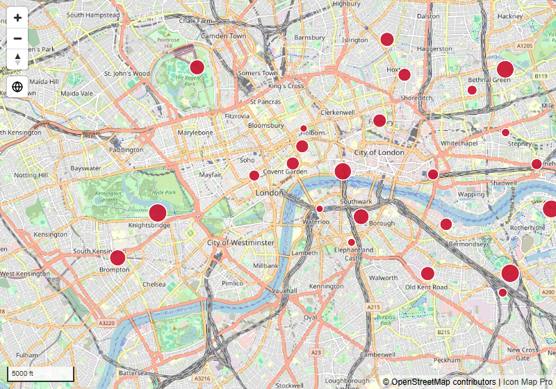
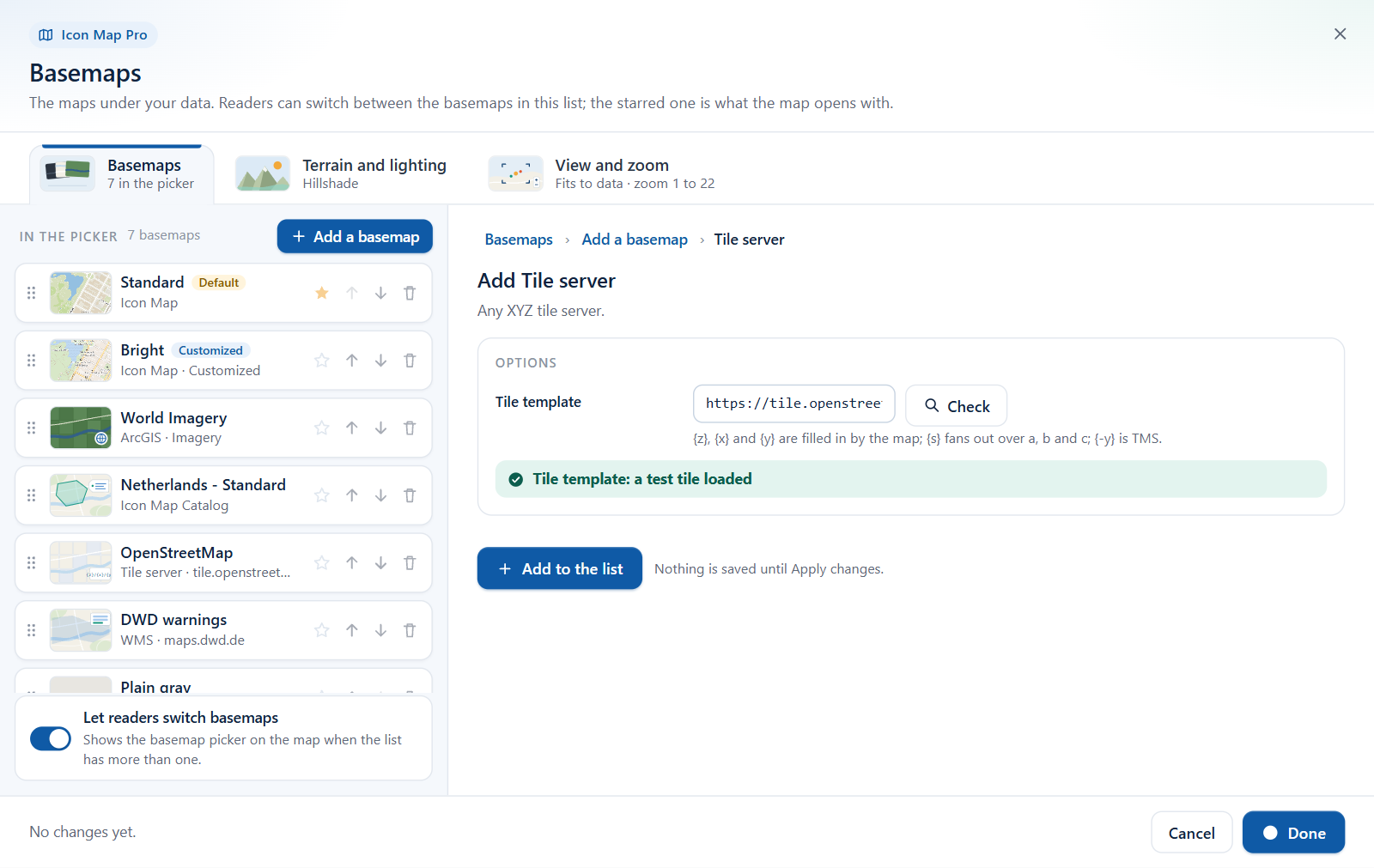
In the Basemaps dialog this is the Tile server tile. Paste the link in Tile template and select Check. The dialog loads a test tile and tells you the result.
Vector Tiles
A complete map style that you host or that a provider gives you a link to. The link must be a MapLibre or Mapbox GL style document: a JSON file with "version": 8 and a list of layers. It is not a tile address. The style names its own tile sources, fonts and icons, and PMTiles sources inside the style work.
In the Basemaps dialog this is the MapLibre style tile. Paste the link in Style link and select Check. A style added this way can be customized layer by layer. See Customize a basemap style.
WMS
One layer from a WMS service, drawn as map images. The service is always requested in Web Mercator (EPSG:3857), so it must support that. The address must start with https://.
In the Format pane, enter WMS Server URL and pick the Layer from the dropdown, which is read from the service. If the list cannot be read, switch on Manual configuration and type the layer name and format.
In the Basemaps dialog:
| Option | What it does | Default |
|---|---|---|
| WMS service address | The service's address. Select Check to read its layers | Empty |
| Layer | The layer to draw. A dropdown filled by Check when adding. A text box when you edit the entry later | The first layer |
| Image format | PNG or JPEG | PNG |
The dialog has no manual mode. A service whose layer list cannot be read from Power BI is refused.
For WMS layers drawn on top of the basemap, including services that need a sign-in, see Raster tiles, WMTS and WMS.
No basemap
None draws no basemap at all. Use it for diagrams, floor plans drawn from your own shapes, or any map where the geography would only distract.
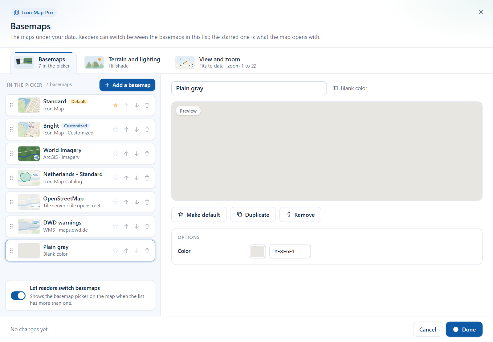
In the Basemaps dialog, the Blank tile adds a plain color instead. Pick the Color with the picker or type a hex value. The default is a warm light gray (#E8E6E1).
New in 1.1.0.11 The dialog also offers Icon Map Catalog basemaps: ready-made national and regional basemaps. See The Basemaps dialog.
Tips and limits
- Credits. ArcGIS, Azure Maps, Mappable and Ordnance Survey show their own credit. Tile servers, style links and WMS services show only what the style itself declares, so add the provider's credit in Format pane > Controls > Additional Attribution.
- Servers must allow Power BI to read them. A Power BI visual can only read from servers that allow cross-origin requests (CORS). If a tile server, style or WMS service does not, the basemap stays blank. There is no proxy switch for the basemap. The proxy is described in API keys, authentication and the proxy.
- Closed networks. Your own tile server, style, WMS service or ArcGIS Enterprise portal works on a network with no internet access, as long as the map can reach it. See Power BI Report Server (on-premises).