
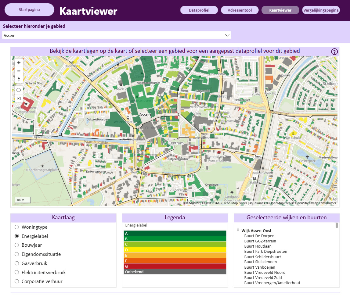
Turning Every Building in Drenthe Into a Filterable Energy Map
For the Province of Drenthe, seeing energy data building by building opens up a much clearer picture of what is happening on the ground.
Location intelligence inside Power BI turns complex oil & gas data into actionable insight for safer operations, efficient production, and stronger ESG performance.
Leverage advanced geospatial visualization to improve production outcomes, predict failures earlier, and strengthen safety across the enterprise.
Plot live well‑head, reservoir, and subsea‑sensor data on Icon Map to highlight under‑performing wells, choke settings, and water‑cut hotspots. Enable engineers to act within hours, not days.
Overlay corrosion, vibration, and thickness‑measurement data on pipelines, jackets, and topsides to predict failures. Target campaigns only where risk is highest to slash fly‑outs and downtime.
Bring together real‑time incident layers such as gas detection, weather, and crew location to support rapid muster, spill modeling, and situational awareness—reducing response time and exposure.
Real Icon Map renders of an offshore basin - blocks, fields, wells, pipelines, terminals - and the same assets under live weather. Infrastructure is ordinary geometry and point layers bound to Lakehouse tables; the weather is live model data fetched anonymously in the browser, with no API keys and nothing about your assets sent anywhere.


Add inspection defects along pipelines, chainage-colored integrity segments, subsurface well paths as 3D lines, or reserves as field-level measures - operations, integrity, and planning from one governed report. Icon Map for Microsoft Fabric is in private preview - join the wait list to run these analyses on your own data.Icon Map for Microsoft Fabric is generally available - start a free 30-day trial from inside Fabric or buy a plan to run these analyses on your own data. The same map, chart, and cross-filter machinery is available today in Icon Map Pro for Power BI.
Field and pipeline geometry is illustrative; the geometry, labeling, live weather, and rendering engines are the shipped product.
Optimize marine logistics, monitor emissions performance, and maximize returns on your existing Microsoft investments.
Track supply vessels, helicopters, and cargo flows against met‑ocean data. Reveal idle steaming, optimize trim and speed, and lower cost per barrel.
Combine satellite flare‑imaging, methane‑sat data, and asset GIS to pinpoint leaks, rank sources, and evidence ESG performance in Power BI scorecards.
Use your existing Power BI and Microsoft data platform infrastructure to avoid costly additional GIS software. Achieve up to 5× cost reduction while removing usage limits with capacity‑based licensing.
Our customer success stories
For the Province of Drenthe, seeing energy data building by building opens up a much clearer picture of what is happening on the ground.

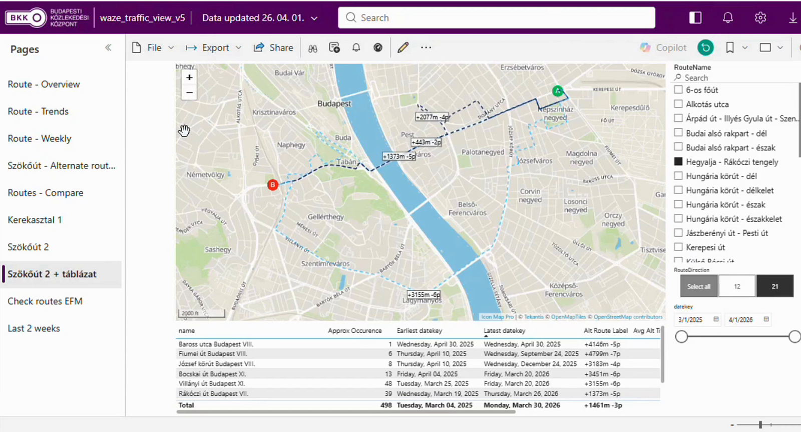
BKK, the Centre for Budapest Transport, is the organization behind the trams, buses and trolleybuses that move people around Hungary's capital, and its remit reaches well past the vehicles themselves. It also coordinates the city's shared bikes and e-scooters…

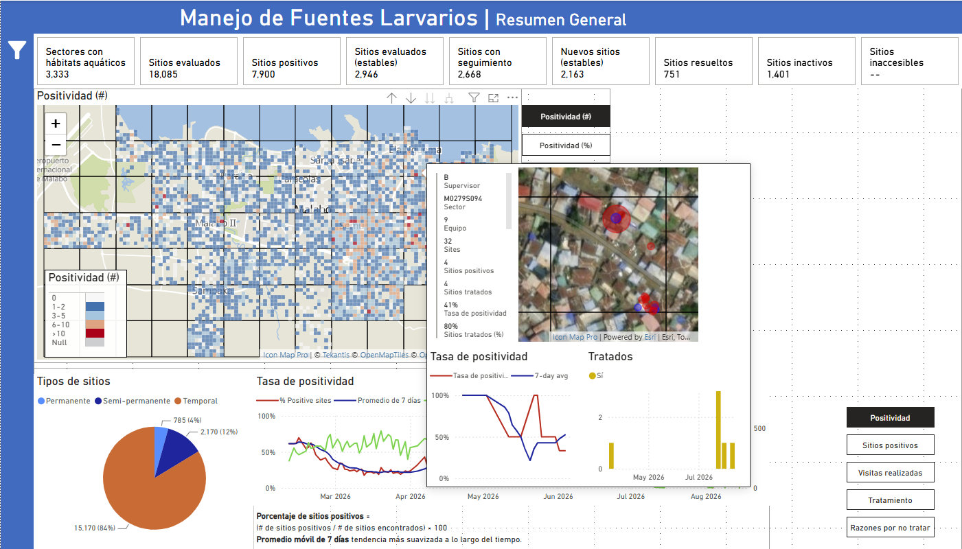
MCD Global Health is a public health nonprofit headquartered in Maine, working across more than 50 countries to design and implement health programmes that genuinely change lives. Their international work spans malaria, cervical cancer, health systems strengt…
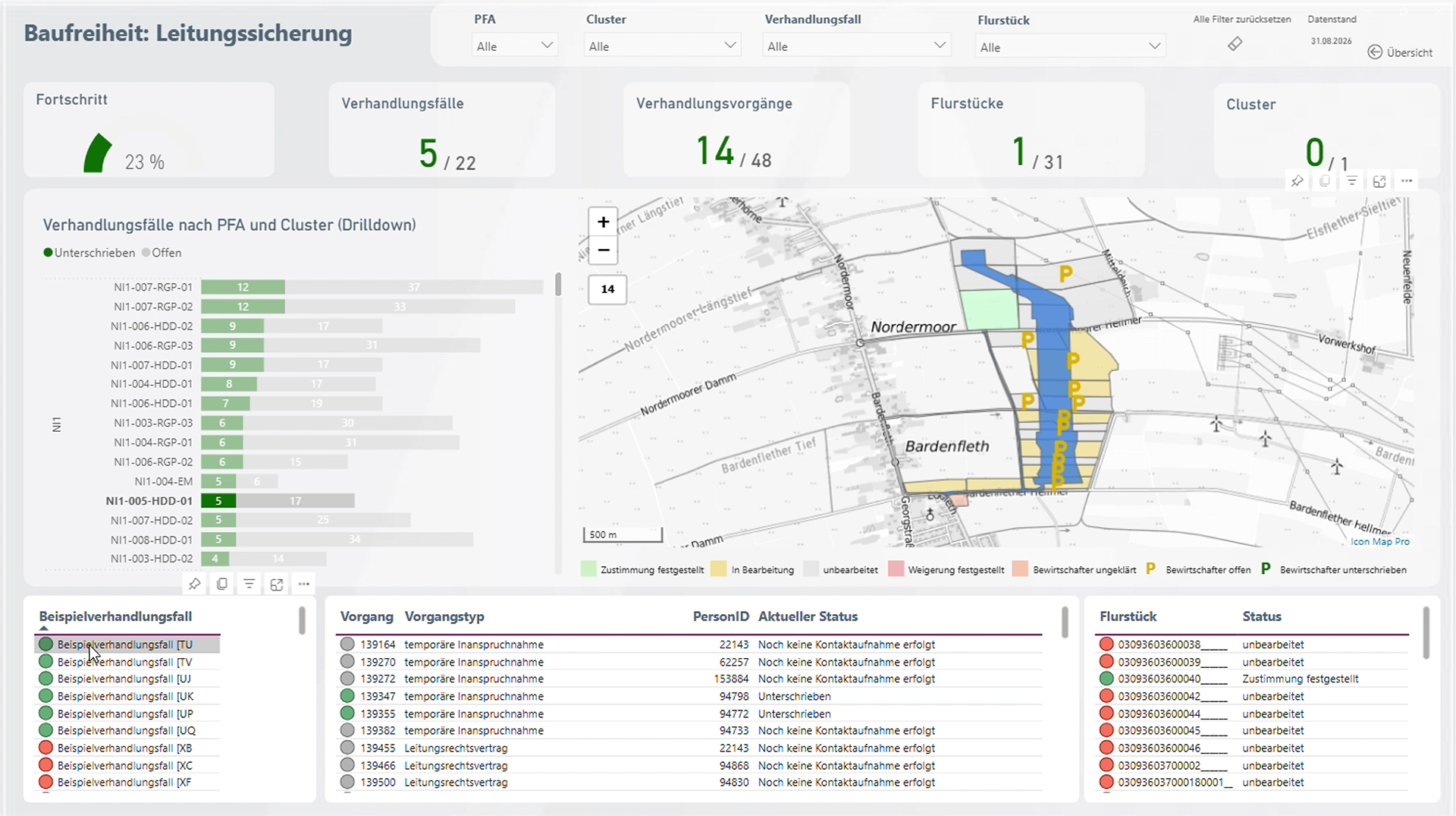
Amprion is one of Germany’s four transmission system operators, responsible for operating and expanding a critical part of Germany’s high-voltage electricity grid. Among its major infrastructure programmes is the Rhein-Main-Link, a planned underground HVDC c…

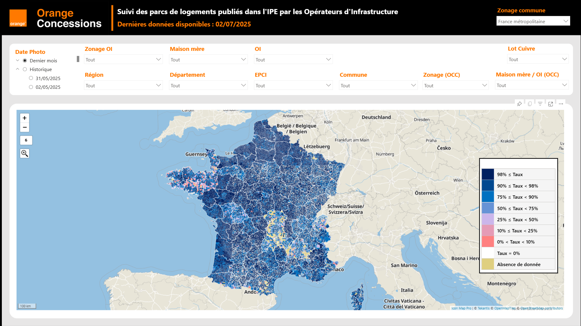
Orange Concessions is the leading public-private fiber network operator in rural France. Through long-term public service delegation contracts, it manages a rapidly expanding network infrastructure designed to bring high-speed broadband access to underserved…

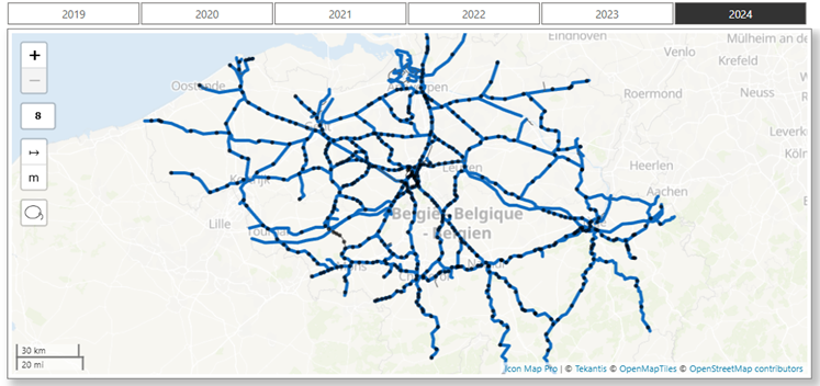
Safety is a cornerstone of SNCB’s operational strategy. As Belgium’s national railway operator, SNCB places significant emphasis on the safety and security of both passengers and staff. CEO Sophie Dutordoir recently stated that all employees' work "deserves r…