
Files and feeds: GeoJSON, KML, CSV, WFS
A file layer draws the points, lines and polygons of a file as context for your data. Link to a GeoJSON file, or upload a GeoJSON, TopoJSON, KML, shapefile or PMTiles file into the report. You can have up to five.
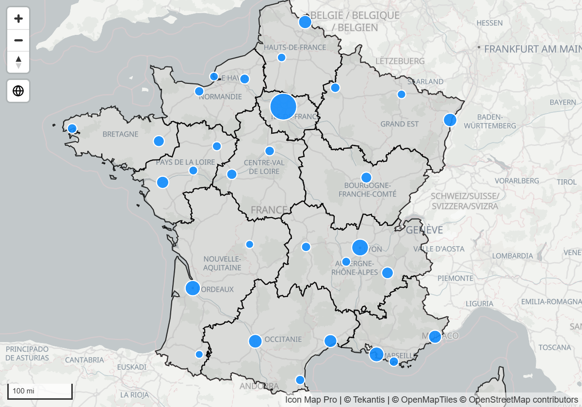
A file layer is not joined to your data. To color shapes by a measure and cross-filter the report when they are clicked, use Shapes from files instead.
Link or upload
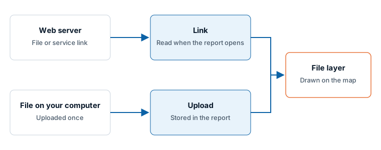
| Link | Upload | |
|---|---|---|
| Where the file lives | On a web server | Inside the report |
| When it is read | Each time the report opens | Once, when you upload it |
| Stays up to date | Yes | No. Upload again to update it |
| Needs | An https:// link, and a server that allows Power BI to read it |
Nothing. It works wherever the report does |
Add a file from a link
- In the Format pane, open Reference Layers > Layer Selection and switch on GeoJSON / Shape / KML File.
- In GeoJSON / Shape / KML - Setup, set Source to URL.
- In GeoJSON / Shape / KML Layer 1 - Configuration, paste the link into URL.
The link must point to a GeoJSON file, and its server must allow Power BI to read it (CORS). For any other format, upload the file.
Upload a file
- In the Format pane, open Reference Layers > Layer Selection and switch on GeoJSON / Shape / KML File.
- In GeoJSON / Shape / KML - Setup, leave Source on Uploaded File.
- In GeoJSON / Shape / KML Layer 1 - Configuration, switch on Display File Upload Button. The switch opens the upload window and turns itself off again.
- Drop a file on the window, or click to browse for one.
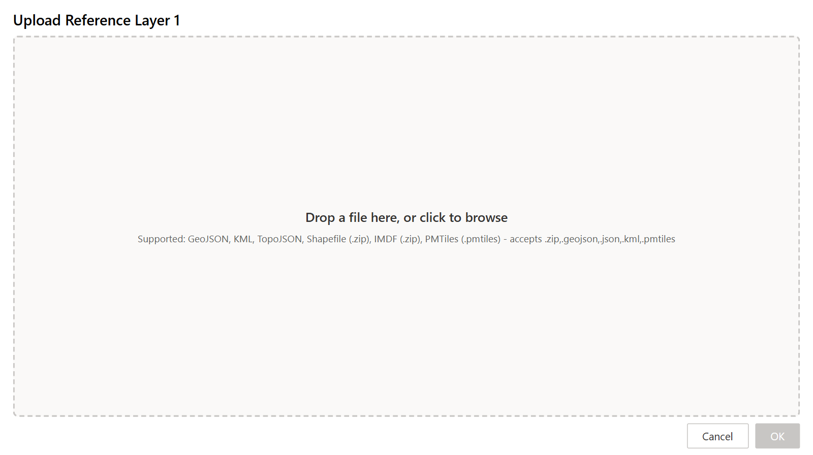
You can upload:
- GeoJSON (
.geojson,.json) - TopoJSON
- KML (
.kml) - A shapefile, zipped (
.zip) - A PMTiles archive (
.pmtiles)
Large files slow a report down. Once a file is loaded, the upload window notes that large files can degrade performance and offers a simplification slider with a suggested value. Simplifying the geometry, reducing the decimal precision of coordinates and removing unused properties before you upload all help.
To take a file out of a layer, open the upload window again and select Remove existing file.
PMTiles archives
A PMTiles archive holds vector tiles in one file, which suits boundary sets that are too detailed for GeoJSON. An archive can be up to 25 MB. If yours is larger, rebuild it with a lower maximum zoom or fewer layers.
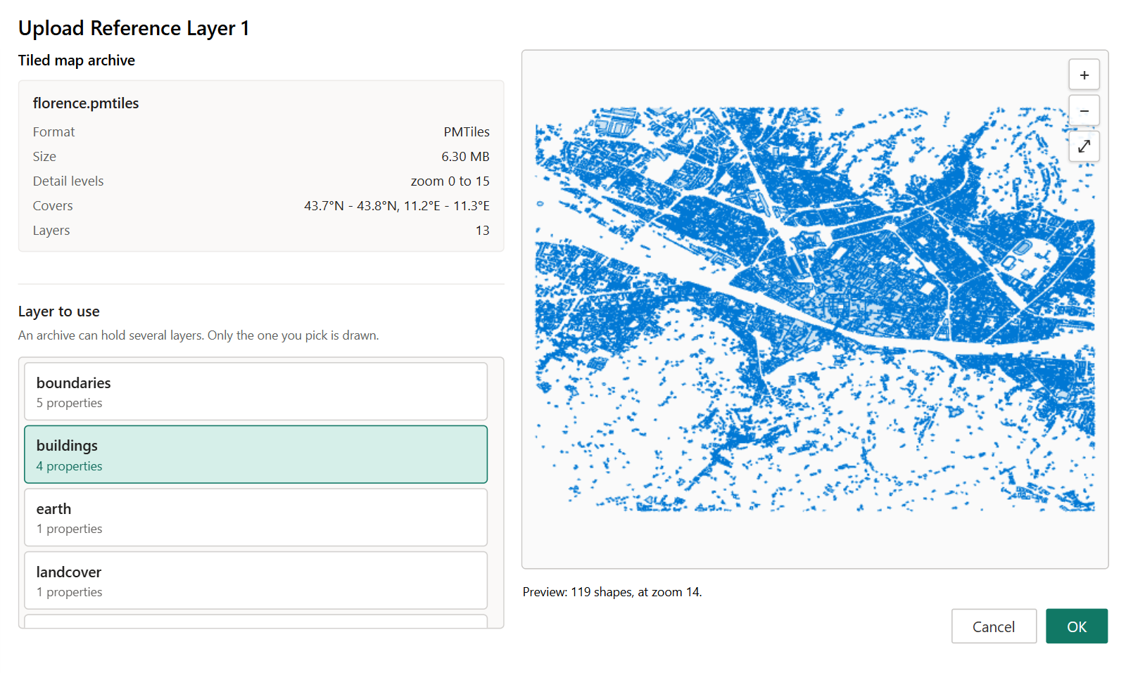
After you choose the file, the window shows its format, size, zoom levels, coverage and layers. An archive can hold several layers and a file layer draws one of them: pick it under Layer to use. To draw three layers of one archive, upload the archive into three file layers and pick a different layer in each.
Polygons, lines and points in an archive are all drawn, and the style, label, tooltip, filter and zoom settings on this page apply to them.
Style the layer
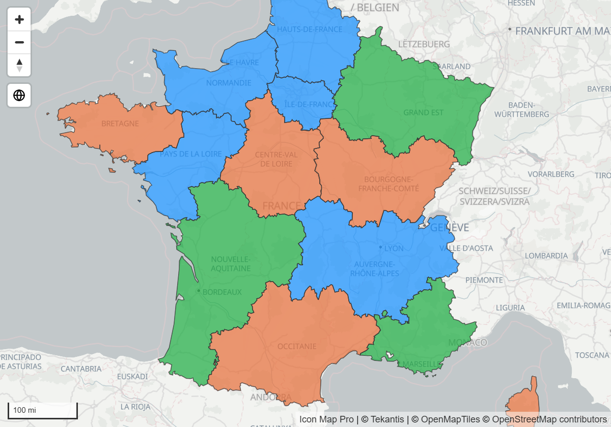
A file layer has one style for all its features, or it can color features by one of their properties. All of the settings below are in the layer's Formatting group in the Format pane.
| To do this | Set |
|---|---|
| One fill color for every shape | Fill Color Type = Static, then Fill Color |
| Color shapes by a number in the file | Fill Color Type = 2 Color Gradient or 3 Color Gradient, then Property for Fill Color and the start, mid and end colors |
| Color shapes by a category in the file | Fill Color Type = Text, then Property for Fill Color and up to ten pairs of Property Value for Fill Color and Fill Color |
| Use the colors written in the file | Switch Override Style off. Style properties in the file, such as fill and color, then win over the pane colors |
| Dashed outlines | Outline Dash Array, for example 4 4 |
| Choose how points are drawn | Show Points As: Pin, Icon from Icon Library, Image or Circle |
Outline colors have the same four types as fill colors.
Show tooltips
Switch on Show Tooltips to show a tooltip when the reader hovers over a feature. With Tooltip Property (1) empty, the tooltip lists every property of the feature. Name a property there to show that one only, and a second one in Tooltip Property (2) if you want. Tooltip Title (1) and Tooltip Title (2) replace the property names with your own text.
Filter the layer by your data
A file layer can show only some of its features. Set Property to Filter to a property of the file and Filter Value to the values to keep.
- Filter Value is a comma-separated list, for example
North, South. Put a value in quotes if it contains a comma:"Yorkshire, East". - A feature is kept when its property, compared as text, is in the list.
- With either setting empty, nothing is filtered.
Filter Value takes conditional formatting (fx). When you bind it to a field or measure, the values of all the rows in the visual are combined, so a slicer that leaves three regions selected leaves three regions on the map. The labels of the layer follow the same filter.
Label the features
Switch on Show Labels and set Label Property Name to the property that holds the text. The style of the labels is set per layer. See Labels on reference layers.
Settings
Setup
Format pane > Reference Layers > GeoJSON / Shape / KML - Setup
| Setting | What it does | Default |
|---|---|---|
| Source | URL shows the settings for a link. Uploaded File shows the settings for an uploaded file | Uploaded File |
| Degrees of Simplification | Simplifies the geometry of a linked file to improve performance. The value is a tolerance in degrees, where one degree is roughly 69 miles. Shown when Source is URL | 0.0001 |
| Number of Layers | How many file layers the map has, 1 to 5 | 1 |
| Apply settings to | The layer whose settings the groups below show. An uploaded layer shows its file name | Layer 1 |
Source
Format pane > Reference Layers > GeoJSON / Shape / KML Layer {n} - Configuration
| Setting | What it does | Default |
|---|---|---|
| URL | The link to a GeoJSON file. Takes conditional formatting (fx). Shown when Source is URL | Empty |
| Source is ArcGIS | Adds your ArcGIS credential to the request, for a file hosted in ArcGIS. Available when the ArcGIS Authentication Type is OAuth2 (Client ID & Secret) or Username & Password | Off |
| Display File Upload Button | Opens the upload window. Shown when Source is Uploaded File | Off |
Tooltips, filter, labels and visibility
These settings are in the same Configuration group. For an uploaded file, the property settings are lists of the file's own properties. For a link, type the property name.
| Setting | What it does | Default |
|---|---|---|
| Show Tooltips | Shows a tooltip when the reader hovers over a feature | Off |
| Tooltip Property (1), Tooltip Property (2) | The properties to show. With the first one empty, every property is shown | Empty |
| Tooltip Title (1), Tooltip Title (2) | Text to show in place of the property name | Empty |
| Property to Filter | The property that the filter compares | Empty |
| Filter Value | The values to keep, separated by commas. Takes conditional formatting (fx) | Empty |
| Show Labels | Draws a label on each feature | Off |
| Label Property Name | The property that holds the label text. Takes conditional formatting (fx) | Empty |
| Visible | Shows or hides the layer. Takes conditional formatting (fx) | Yes |
| Minimum Zoom | The layer is hidden when the map is zoomed out past this level | 0 |
| Maximum Zoom | The layer is hidden when the map is zoomed in past this level | 24 |
| Z-Index | Drawing order, 0 to 1000. Higher is nearer the viewer | 365 |
Formatting
The group is named after the layer and ends in Formatting.
| Setting | What it does | Default |
|---|---|---|
| Show Points As | How points are drawn: Pin, Icon from Icon Library, Image or Circle | Pin |
| Circle Size | Size of each circle, 0 to 200. Shown for Circle | 10 |
| Image URL, Image Size | The image to draw at each point and its size, 0 to 200. Shown for Image | Empty, 10 |
| Icon Name, Icon Size, Icon Color | The icon to draw at each point, its size (0 to 200) and its color. Shown for Icon from Icon Library | Empty, 10, #000000 |
| Show Icon Library | Opens the icon library so you can find an icon name | Off |
| Override Style | On: the colors in the pane are used. Off: style properties inside the file win | Off for layer 1, on for layers 2 to 5 |
| Fill Color Type | Static, 2 Color Gradient, 3 Color Gradient or Text | Static |
| Fill Color | The fill color for Static. Takes conditional formatting (fx) | #555555 |
| Property for Fill Color | The property that drives a gradient or a Text color. Takes conditional formatting (fx) | Empty |
| Start Color, Mid Color, End Color | The colors of a gradient. Mid Color is for 3 Color Gradient | Theme colors |
| Enter value for start, Enter value for mid, Enter value for end | Switch on to type the value at which each gradient color applies, in Start Value, Mid Value and End Value. The values take conditional formatting (fx) | Off |
| Default Fill Color | The color of a feature that has no value for the property, or no match | #555555 |
| Fill Color 1 to Fill Color 10, Property Value for Fill Color 1 to 10 | For Text: a color for each property value | |
| Fill Transparency | 0 is solid, 100 is invisible | 30 |
| Outline Color Type | As Fill Color Type, for outlines and lines. The outline has the same set of color, property, gradient and text settings as the fill | Static |
| Outline Color | The outline color for Static. Takes conditional formatting (fx) | #000000 |
| Outline Transparency | 0 is solid, 100 is invisible | 20 for layer 1, 0 for layers 2 to 5 |
| Outline Width | Width of outlines and lines, 0 to 100 | 1 |
| Outline Dash Array | Space-separated dash and gap lengths, for example 4 4. Empty draws a solid line |
Empty |
Tips and limits
- Features of a file layer cannot be selected and do not cross-filter the report.
- Each file layer draws one file. Use Number of Layers for up to five.
- A PMTiles archive can be up to 25 MB and each file layer draws one of its layers.
- If the map slows down, simplify the file. Fewer vertices and fewer properties make the largest difference.
Related
- Reference layers overview
- Labels on reference layers
- Shapes from files - the same files, joined to your data
- Legend