
Routes
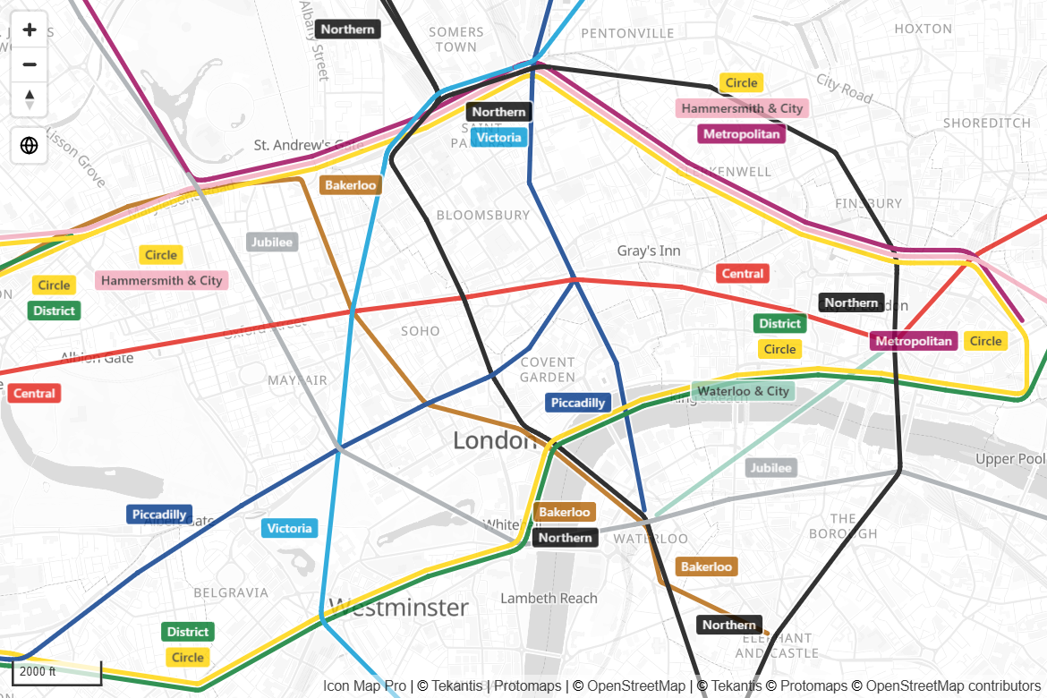
Routes is a line shape for networks where several lines use the same street or track. Instead of drawing them on top of each other, Icon Map Pro draws them side by side, each in its own color, splitting and merging smoothly as on a bus or metro map.
How it works
With an ordinary line shape, three routes along the same street are three lines in the same place, and you only see the one on top. With Routes, the map works out which lines share a street and gives each one its own lane.
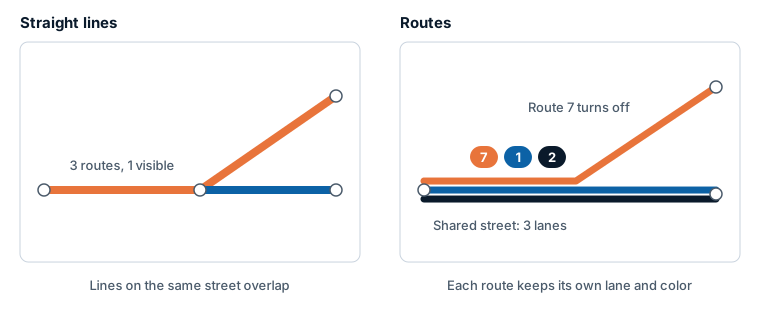
- Rows with the same Route Name and the same color are one route, and take one lane.
- Where routes run along the same street, their lanes sit beside each other with a thin outline between them.
- Where a route leaves the street, its lane peels away smoothly. The route that turns off to the left runs on the left, so lanes do not cross more than they need to. Routes that never part are ordered by name, so route 1 is to the left of route 2.
Routes works at any zoom level, on a tilted map, on the globe and with 3D terrain.
What you need
Routes is available in two layers. Use whichever matches your data.
| Your data | Layer | Setting to choose |
|---|---|---|
| One row for each link between two stops, with the coordinates of both ends | Lines | Line Shape = Routes |
| One row for each route or section, with its path as WKT or GeoJSON text | Shapes from data | Linestring Shape = Routes |
For the Lines layer, each row is one straight link from stop to stop:
| ID | Route | Longitude (X) | Latitude (Y) | Destination Longitude | Destination Latitude |
|---|---|---|---|---|---|
| 7-001 | 7 | -0.3712 | 50.8179 | -0.3761 | 50.8151 |
| 7-002 | 7 | -0.3761 | 50.8151 | -0.3824 | 50.8139 |
| 1-001 | 1 | -0.3712 | 50.8179 | -0.3761 | 50.8151 |
| 1-002 | 1 | -0.3761 | 50.8151 | -0.3790 | 50.8098 |
In this example routes 7 and 1 share the first link, then go different ways. The Route column is not placed in a field well. It is used for the Route Name and the color through conditional formatting.
Draw routes
- Add the fields for the Lines layer and turn the layer on.
- In Format pane > Data Layers > Lines - Formatting, set Line Shape to Routes.
- Next to Route Name, select the conditional formatting (fx) button, choose Field value and pick your route field.
- Next to Color, select the fx button and give each route its color, either from a field that holds a color or with rules.
- Set Width to the width of one lane.
For shapes held as WKT or GeoJSON text, follow the same steps in Format pane > Data Layers > Shapes (from data) - Configuration: set Linestring Shape to Routes and set Route Name with conditional formatting. The lane color is the shape's Outline Color and the lane width is its Outline Width, both in Shapes (from data) - Formatting.
Settings
These settings appear when the Routes shape is chosen. They are the same in the Lines card and the Shapes (from data) card.
| Setting | What it does | Default |
|---|---|---|
| Route Name | Rows with the same route name and color are drawn as one route, side by side with the others on the same streets. It is also the text of the route badges. Use conditional formatting (fx) to take it from a field. | Empty |
| Merge Distance (m) | Lines closer than this, running the same way, count as the same street. Use it for route shapes that do not share exact points, or for the two sides of a divided road. Loops smaller than about ten times this distance, such as roundabouts, are drawn as one junction. 0.5 to 1000. | 5 for Lines, 20 for Shapes from data |
| Route Outline Color | The color of the outline around each route. | #FFFFFF |
| Route Outline Width | The outline around each route, which is also the gap between routes on the same street. 0 draws them touching. 0 to 20. | 1.5 |
| Route Badges | Shows each route's name in a badge of its color, beside the lines. Needs a Route Name. | On |
Settings from the rest of the card that Routes uses:
| Setting | How Routes uses it |
|---|---|
| Color (Lines) or Outline Color (Shapes from data) | The color of the route. Rows of one route should have one color. |
| Width (Lines) or Outline Width (Shapes from data) | The width of the route's lane. A route is as wide as its widest row. |
| Transparency | The transparency of the route. |
| Minimum Zoom, Maximum Zoom | The zoom range in which the routes are drawn. |
| Z Index | The position of the routes in the drawing order. |
| EPSG | The coordinate system of your coordinates. |
Routes are one solid color each. Color Type (gradients), dashes, blur, Invisible Line Width and line symbols do not apply and are hidden. In the Lines card the images at the start and end are hidden too.
Route badges
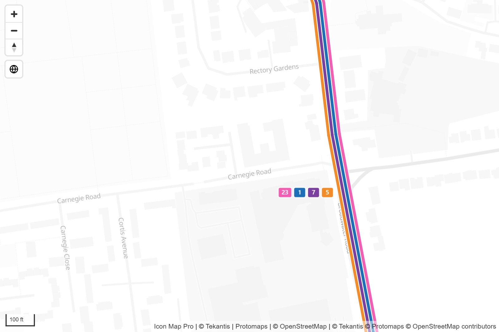
With Route Badges on, each route's name is shown in a small badge of the route's color beside long shared stretches. Badges never overlap each other and are not repeated close together. Turn badges off if you would rather label routes another way.
Selection and tooltips
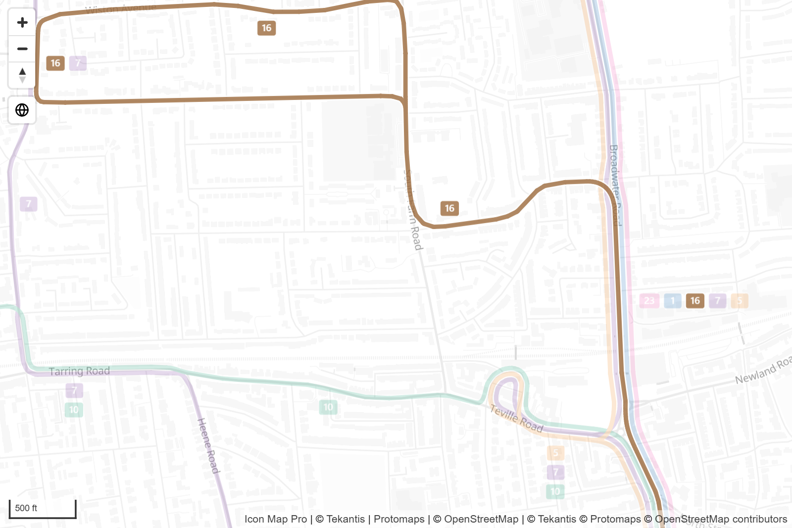
- Clicking a route selects all the rows of that route and cross-filters the rest of the report. Hold Ctrl to add another route. Selected routes are drawn on top and the others are dimmed.
- Pointing at a route shows the tooltip for the stretch under the pointer. If the stretch is one row you see that row's values. If it covers several rows, the tooltip fields are summarized across them.
- Data labels, when turned on, are placed at the midpoint of each link.
Tips and limits
- Show the stops. With the Lines layer, set Include circle(s) at: to draw a circle at the ends of each link, or add the stops as their own rows for the Circles layer. See Combine several layers in one map.
- Routes do not line up. If two routes follow the same street but are drawn apart, their coordinates differ slightly. Increase Merge Distance (m). If routes on different, nearby streets are pulled together, reduce it.
- A route splits into several lanes. Rows are one route only when both the name and the color match. Check that every row of a route has the same color.
- No Route Name. Without a route name, all rows of one color are treated as one route.
- Very short stubs, less than about three times the merge distance, are not drawn.
- Routes is available on the Modern engine. See Modern and Legacy engines.