
Select everything inside a shape
Click a region, a route or a site on the map and select every item that lies inside it or touches it. Use a shape from your data, or the polygons of a GeoJSON, shapefile or KML reference layer, such as sales territories or flood zones.
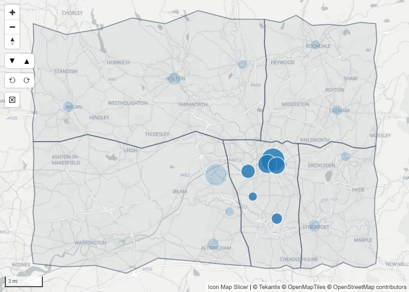
There are two ways to do this:
| Setting | You click | Where to switch it on |
|---|---|---|
| Select Intersecting Items | An item of a data layer: a shape, a line or a point. | Format pane > Selection > User Selection |
| Use Polygons for Selection | A polygon of a GeoJSON / Shape / KML reference layer. | Format pane > Reference Layers > GeoJSON / Shape / KML Layer {n} - Configuration |
Both use the same two settings, Select Buffer and Select Mode, to decide what is selected.
Select from an item on the map
- Open Format pane > Selection > User Selection and switch on Select Intersecting Items.
- Set Select Buffer and Select Mode. They appear when the switch is on.
- Click an item on the map.
The clicked item is selected, together with every item that lies inside it, or touches it, once its outline is grown by the buffer distance.
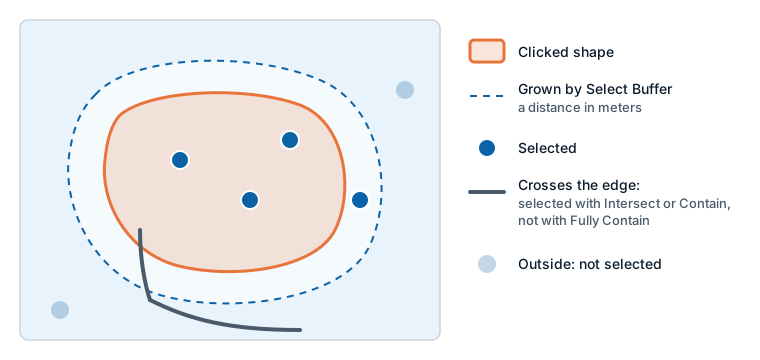
Hold Ctrl or Shift while you click to add to the current selection.
Select Buffer
Select Buffer grows the clicked item's whole shape by a distance in meters before it looks for other items. Some examples:
- Click a store's circle with a buffer of 500 to select every store within 500 meters of it. A point counts with the size it is drawn at, so the buffer is added to the circle's radius.
- Click a road with a buffer of 100 to select everything within 100 meters of the road.
- Click a region with a buffer of 0 to select what is inside its border.
A negative value shrinks a shape instead, which leaves out items close to its border. The range is -10,000 to 10,000 meters.
Select Mode
| Select Mode | Selects |
|---|---|
| Fully Contain (default) | Only items that lie entirely inside the buffered shape. |
| Intersect or Contain | Items that lie inside the buffered shape or touch it. |
A point is either inside or outside, so the mode matters for lines and shapes.
Select Mode applies only to these two features. The lasso, circle select and travel time use Lasso Mode instead.
Select with the polygons of a reference layer
A GeoJSON / Shape / KML reference layer is not joined to your data, so its polygons cannot be selected themselves. They can be used to select the data items inside them.
- Add the reference layer. See Files and feeds.
- Open Format pane > Reference Layers > GeoJSON / Shape / KML Layer {n} - Configuration for that layer.
- Switch on Use Polygons for Selection.
- Click a polygon of the layer on the map.
Every polygon of the layer under the pointer is used, together. The items inside them, or touching them, are selected by Select Buffer and Select Mode, as above. Hold Ctrl or Shift to add to the selection.
Things to know:
- It works whether Select Intersecting Items is on or off.
- Select Buffer and Select Mode are shown in the pane only while Select Intersecting Items is on. With it off, the values last set still apply: by default no buffer and Fully Contain. To change them, switch Select Intersecting Items on, set them, and switch it off again.
- Only polygons count. Points and lines in the reference layer are ignored.
- A reference layer from a PMTiles archive works too. Its polygon is put together from the tiles loaded for the current view, so a polygon that runs far off screen is cut near the edge of the view, and on a zoomed-out map its outline is simplified.
- Use Polygons for Selection is set in the Format pane only. The Layer Manager does not show it.
- Each GeoJSON / Shape / KML reference layer has its own switch, default off.
Settings
| Setting | Where | What it does | Default |
|---|---|---|---|
| Select Intersecting Items | Selection > User Selection | A click on a data item also selects the items inside or touching it. | Off |
| Select Buffer | Selection > User Selection | The distance in meters added around the clicked shape, -10,000 to 10,000. | 0 |
| Select Mode | Selection > User Selection | Fully Contain or Intersect or Contain. | Fully Contain |
| Use Polygons for Selection | Reference Layers > GeoJSON / Shape / KML Layer {n} - Configuration | A click on a polygon of this reference layer selects the data items inside it. | Off |
Tips and limits
- Items are looked for across the whole map, not only in the current view. When a data layer is drawn from vector tiles, only the items in view count.
- With Fully Contain, a large shape that only partly lies on another shape does not select it. Switch to Intersect or Contain to include shapes that overlap.
- Selecting thousands of items can pass Max Selections. See Limit how many items can be selected.