
Filter by the map view
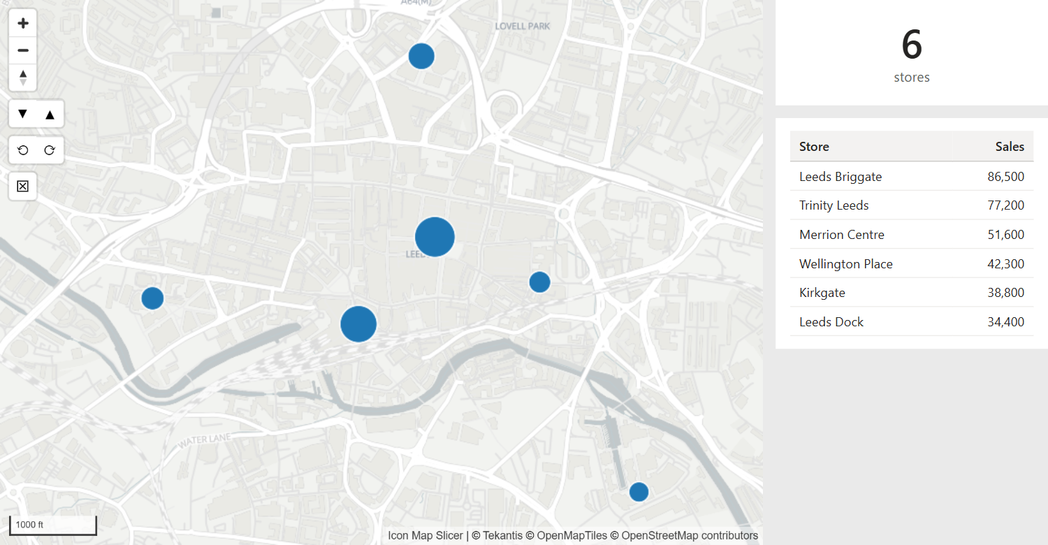
Pan and zoom the map, and the other visuals on the page show only the rows whose coordinates are inside the area you can see. Zoom in on a city and a table beside the map lists only the stores in that city.
How it works
Each time a reader moves the map, Icon Map Slicer reads the edges of the view and filters two fields of your data:
- the latitude field to values from the south edge up to the north edge
- the longitude field to values from the west edge up to the east edge
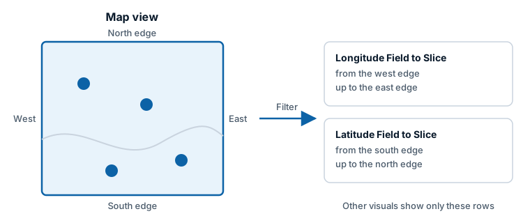
This filter is for the other visuals on the page. The map itself is not filtered by its own view: it keeps every item, so a reader can pan back out.
Set it up
You need a latitude column and a longitude column, in decimal degrees, in a table that your other visuals relate to. They are usually the same columns you use for Longitude (X) and Latitude (Y).
- Select the map, and in the Format pane open Selection > Map Location.
- Next to Longitude Field to Slice, select fx. Choose Field value, pick your longitude column, and select OK. Any summarization works.
- Do the same for Latitude Field to Slice with your latitude column.
- Pan or zoom the map. The other visuals are filtered to the area in view.
The map is set up again when you change either field, so it may redraw.
Both fields must be columns from a table, not measures, because the filter is applied to the column.
When the filter updates
- When a reader drags, zooms, tilts or rotates the map, the filter updates at the end of the move.
- Moves the map makes by itself, such as zooming to fit the data, do not change the filter.
- Until the map is first moved, there is no filter and the other visuals show all their rows.
With item selection
The map view filter works alongside selecting items on the map. When you move the map while items are selected, the other visuals are filtered to the selected items that are also inside the view.
Selecting or clearing items keeps the map view filter, so the other visuals stay limited to the area in view as well.
Settings
In Format pane > Selection > Map Location:
| Setting | What it does | Default |
|---|---|---|
| Longitude Field to Slice | The longitude column to filter, chosen with fx > Field value. | Empty |
| Latitude Field to Slice | The latitude column to filter, chosen with fx > Field value. | Empty |
The group also shows two lines of help: "Filter the selected longitude and latitude fields based on the extent and zoom level of the map." and "This will filter other visuals on the report page, but not Icon Map Slicer itself."
Tips and limits
The filter is a rectangle of latitudes and longitudes. When the map is tilted, the rectangle is the box around everything visible, which reaches farther toward the horizon than it looks.
A view that crosses the 180 degree meridian filters both sides of it. When the view shows the whole width of the world, longitude is not limited.
While you edit the report with Auto Zoom off, moving the map also saves the view as the map's default view. See View, zoom and projection.
The filter is saved with the report and in bookmarks, like the item selection.