
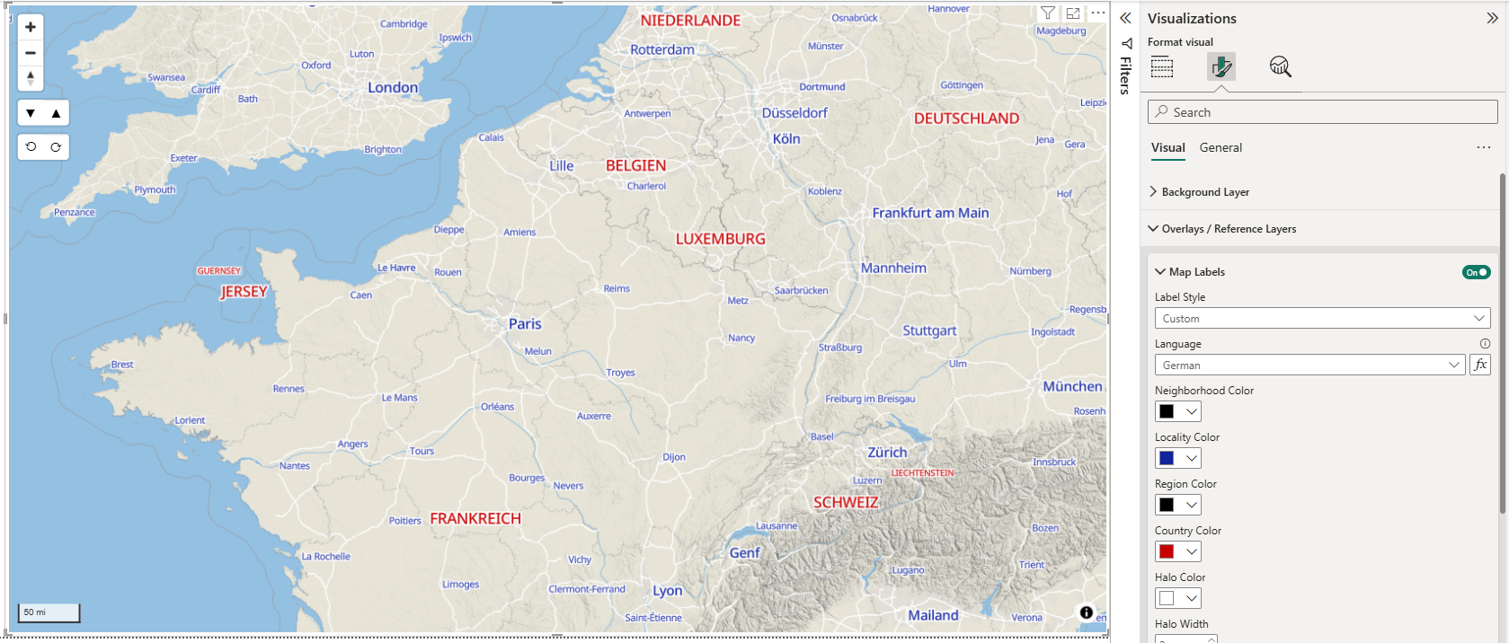
Map Labels
The Map Labels overlay options allow you to display place names independently from the background layer. This is useful for displaying place names over your data layers which might entirely obscure the background layer.
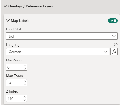
Map Labels from Icon Map
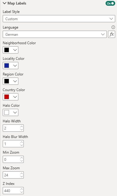
You can either use the labels from one of the background map styles, or choose custom to be able to modify the colors.
Min and Max Zoom
Min and Max zoom determine the map zoom levels at which the labels appear.
Z-Index
Z-Index determines the order in which layers are drawn on the map. Choose a high Z-Index number if you would like your map labels to appear over data items such as circles.
For styles based on Protomaps, you can specify the language. It is possible to set the language to match your Power BI report by passing a DAX expression. The value should be a string containing the 2 letter code representing the language. Refer to the table below for values.
Selecting "Custom" additionally enables formatting options allowing you to change the colors of the labels:
Language settings
| Value | Language |
|---|---|
| ar | Arabic |
| bg | Bulgarian |
| zh-Hans | Chinese (Simplified) |
| zh-Hant | Chinese (Traditional) |
| hr | Croatian |
| cs | Czech |
| da | Danish |
| nl | Dutch |
| en | English |
| et | Estonian |
| fi | Finnish |
| fr | French |
| de | German |
| el | Greek |
| he | Hebrew |
| hi | Hindi |
| hu | Hungarian |
| id | Indonesian |
| ga | Irish |
| it | Italian |
| ja | Japanese |
| ko | Korean |
| lv | Latvian |
| lt | Lithuanian |
| mt | Maltese |
| mr | Marathi |
| ne | Nepali |
| no | Norwegian |
| fa | Persian |
| pl | Polish |
| pt | Portuguese |
| ro | Romanian |
| ru | Russian |
| sk | Slovak |
| sl | Slovenian |
| es | Spanish |
| sv | Swedish |
| tr | Turkish |
| uk | Ukrainian |
| ur | Urdu |
| vi | Vietnamese |