

It's day 8 of the 30 Day Map Challenge, and today's theme is utopia.
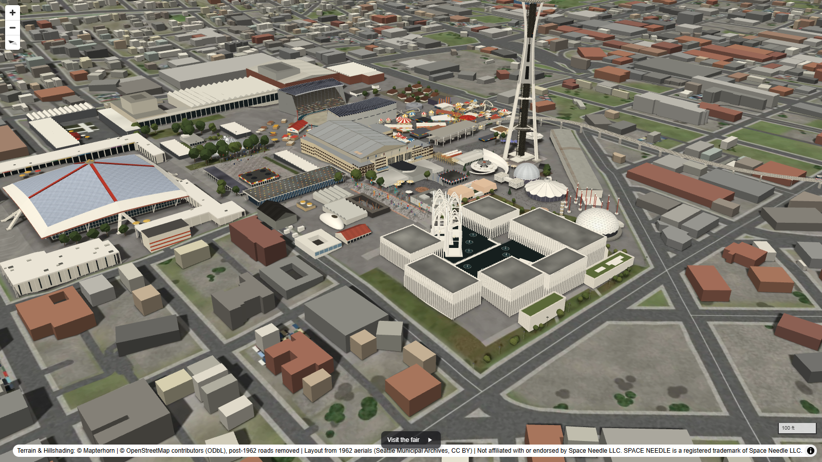
For me, few places have tried harder to build a utopia than a world's fair, and the 1962 Century 21 Exposition in Seattle was all about the future: life in the 21st century, the space age, and a monorail to get you there. So this map rebuilds the fair in 3D, along with the city around it as it stood that summer.
The fair's own buildings are modelled from photographs taken at the time. A colour aerial of the fair from 1962 was lined up against the surveyed roofs of the buildings that still stand today, which puts each pavilion in its place to within about 3 metres, and then each one was shaped and coloured from period photographs. The monorail runs on its guideway from downtown, with two trains shuttling back and forth.
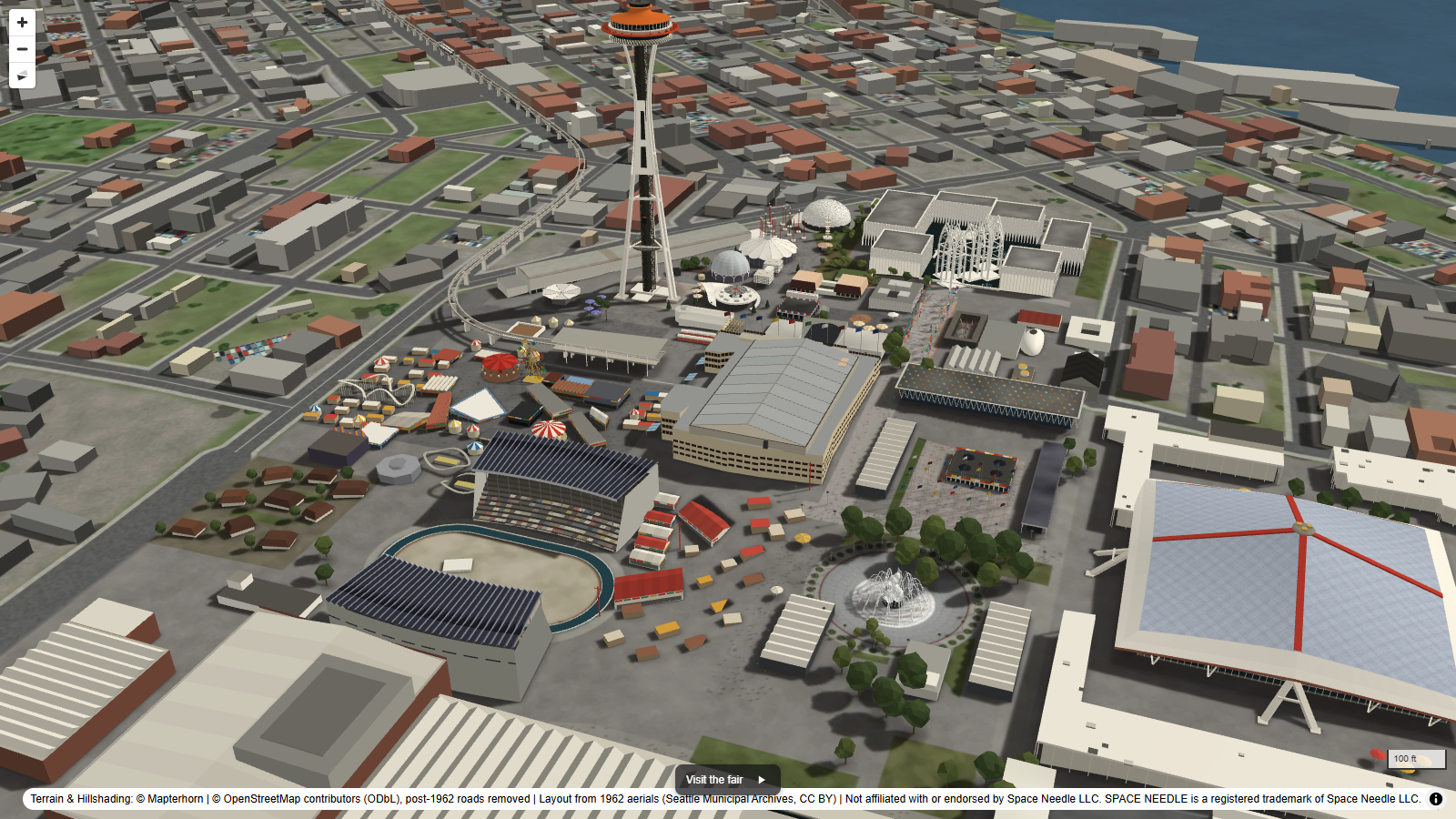
The city around the fair was the bigger puzzle, because there's no map of every building standing in Seattle in 1962. Seattle's oldest building outlines are from 1993, so each of those was dated using the King County Assessor's year built, anything built after 1962 was taken out, and gaps were filled by tracing the City's 1936 aerial photograph. That leaves 208,515 buildings. The roads are today's minus the later freeways, so the Alaskan Way Viaduct is back on the waterfront and Interstate 5 is a scar of raw earth, still under construction.
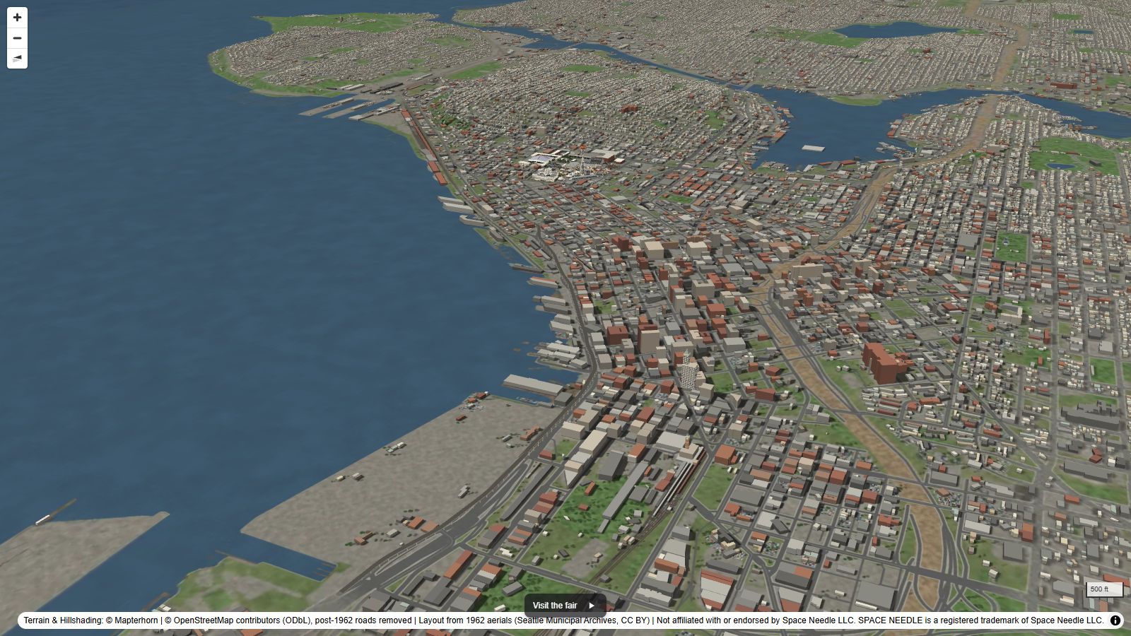
Press Visit the fair at the bottom of the map for a guided tour, or fly around it yourself.
How did I build it?
As with Pompeii on day 6, I used Icon Map's MCP service, which can generate 3D models, so the fair's pavilions, the monorail and its trains were built from prompts and the reference photographs. The city is a vector tile layer of building footprints extruded to their surveyed heights, the monorail is a vehicle layer replaying the two trains on a loop, and the ground is painted to look like the period, with roads built after 1962 removed.
How accurate is it?
The buildings that survive, like the Coliseum, the Armory and the Science Pavilion, sit on their surveyed footprints, but everything is modelled by eye from photographs, not from drawings, so details and some dimensions are approximate. A few parts of the fair don't appear in any photograph I could find, so the houses of the Japanese village east of the stadium and the stalls and small coaster at the east end of the Gayway are my best guess, and the Ferris wheel's position is uncertain.
In the city, buildings put up after 1936 and gone before 1993 don't appear in any of the sources, so they're missing, and a few buildings shown may have gone by 1962. Heights come from the 1993 survey's highest point, so pitched roofs are drawn flat at their peak. The terrain is today's too, so later fills and regrading aren't undone.
Sources
Buildings: City of Seattle building outlines (1993, 2015 and 2023) and its 1936 aerial photograph, used to trace outlines only. Year built from the King County Assessor.
Fair layout and colours: Aerial of Seattle World's Fair, 1962 and Aerial of Seattle Center, 1963, Seattle Municipal Archives, CC BY 2.0, via Wikimedia Commons, with other period photographs as reference.


Roads, rail and the monorail guideway: © OpenStreetMap contributors, available under the Open Database License, with roads built after 1962 removed.
Terrain: © Mapterhorn.
This map is not affiliated with or endorsed by Space Needle LLC. SPACE NEEDLE is a registered trademark of Space Needle LLC.