

It's day 7 of the 30 Day Map Challenge, and today's theme is a 10 minute map.
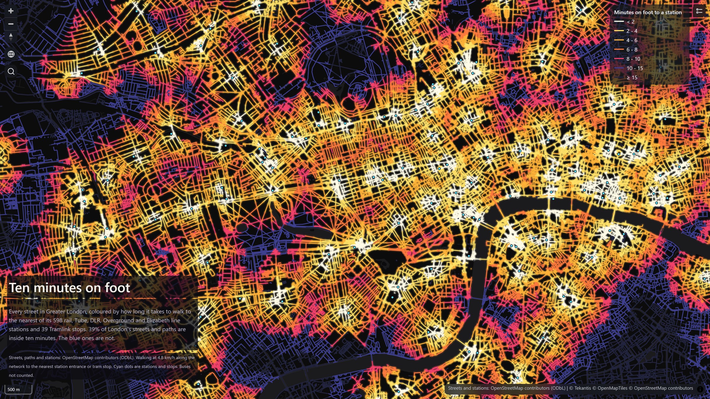
Rather than a map made in ten minutes, I've gone for a map of ten minutes: how far you can get on foot from a station in London. Every street and path in Greater London is coloured by how long it takes to walk to the nearest rail, Tube, DLR, Overground or Elizabeth line station, or Tramlink stop. White is less than two minutes away, then it runs through gold, orange and pink to ten minutes. Anything further than that turns blue.
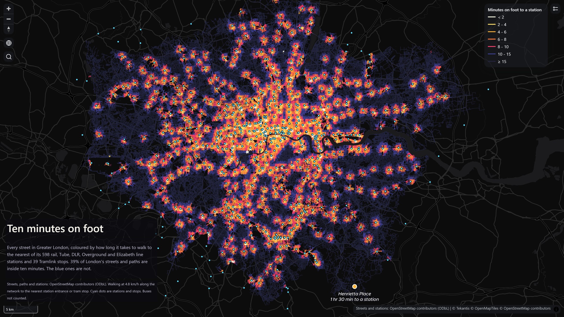
From a distance it looks like a city at night. In the middle, almost every street is within a few minutes of a station. Further out, each station sits in its own little pool of light, strung along the railway lines, with blue gaps in between. Overall, 39% of London's streets and paths are within a ten minute walk of one of its 598 stations and 39 tram stops.
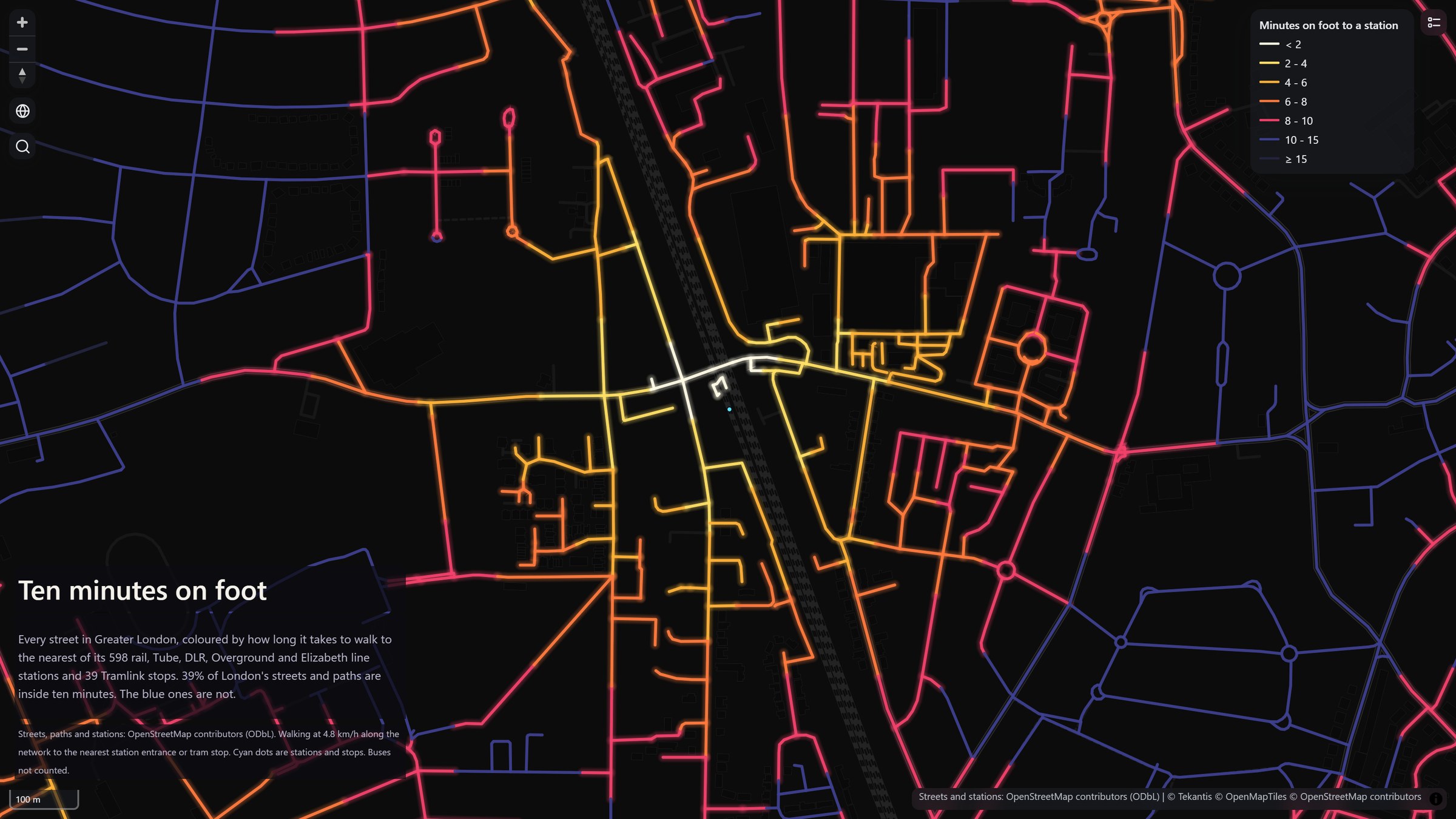
The walk is measured along the streets, not as the crow flies, so the colour follows the roads out from each station. Here's North Wembley up close:
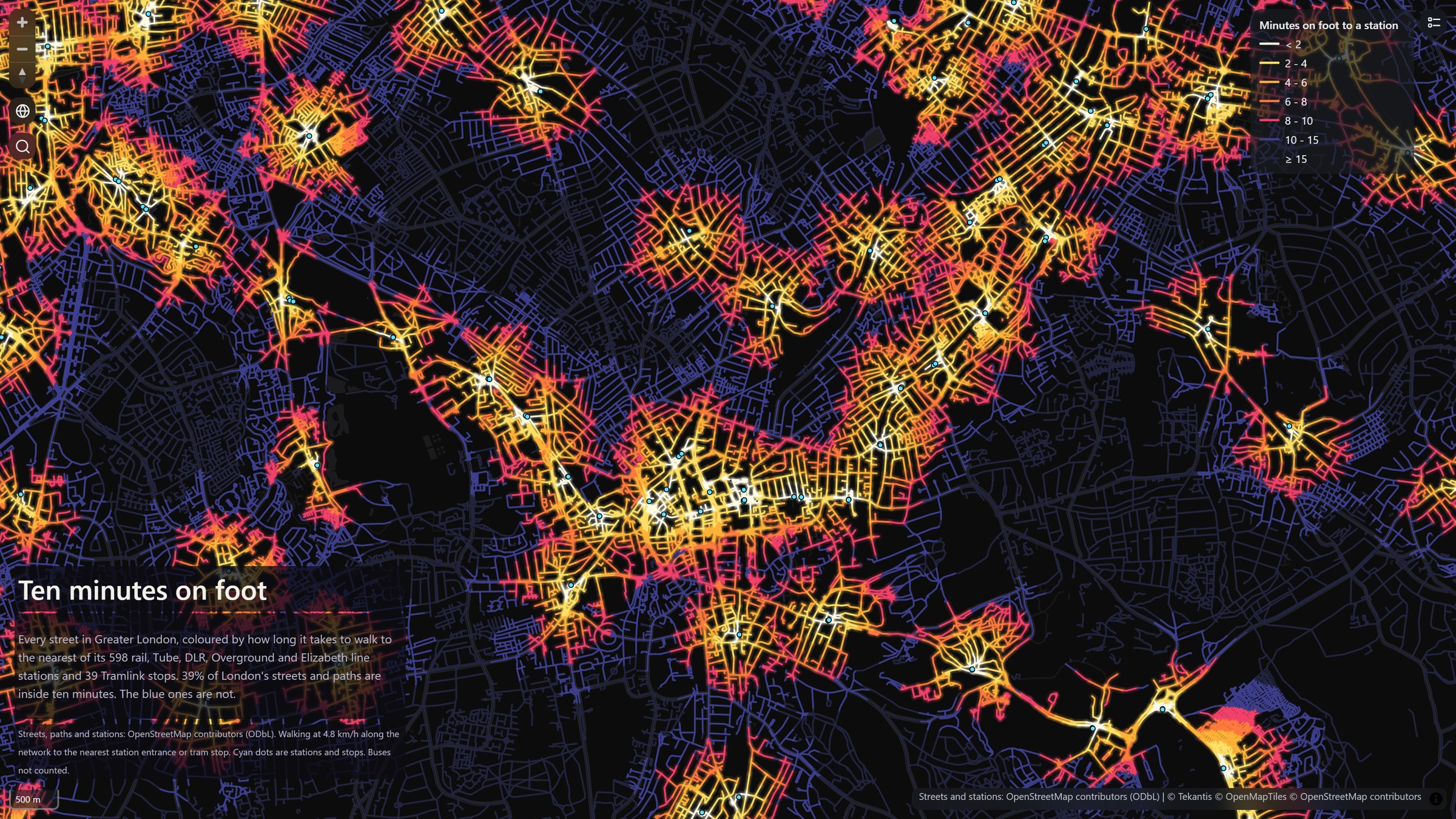
The trams make a real difference in south London. New Addington, for example, is more than 4 km from the nearest railway station, so without its tram stops it would be almost entirely blue.
And the longest walk? Henrietta Place in Berry's Green, near Biggin Hill, is the furthest residential street in London from a station. It's about an hour and a half on foot, 7.2 km along the lanes. Zoom out on the map to find it.
You can search for a street or a place using the magnifying glass to see how your own walk compares.
How did I build it?
I built this one using Icon Map's MCP service. The streets, paths and stations all come from OpenStreetMap. I took every way you can walk along, from main roads down to footpaths and alleys, and turned them into a network of about three million points. Then I worked out the shortest walk from every point to the nearest station all in one go, starting from the station entrances where they're mapped and from the station itself where they aren't.
The network carries on a few kilometres beyond the London boundary, so the stations just over the border count too. Otherwise the streets on the edge of London would look much further from a station than they really are.
The result is cut into short pieces, coloured by the minutes, and saved as a vector tileset of nearly half a million lines on OneLake. Each street is drawn twice, a soft blurred copy underneath and a sharp line on top, which is what gives it the glow.
How accurate is it?
The walking speed is a steady 4.8 km/h, with no time added for crossing roads, climbing stairs or hills, so real walks will often take a little longer. The walk ends at the station entrance, not on the platform.
It's only as good as OpenStreetMap, which is very good in London but not perfect. If a path is missing, or a stretch of footpath isn't joined to the rest of the network in the data, the streets beyond it show as further away than they really are. Around 1% of the street length isn't connected to anything, and shows up in the darkest blue.
The 39% is a share of the length of streets and paths, not of people or homes, so it includes footpaths through parks and lanes across farmland on the edge of London. Pavements mapped separately from their roads are used for the walking but aren't drawn or counted, so the roads aren't counted twice. Buses aren't included at all.
Sources
Streets, paths, stations and tram stops: © OpenStreetMap contributors, available under the Open Database License. Extract from Geofabrik, downloaded 6 November 2026.
Greater London boundary: © OpenStreetMap contributors, available under the Open Database License.
Basemap: © OpenMapTiles © OpenStreetMap contributors.