

It's day 6 of the 30 Day Map Challenge, and today's theme is vintage.
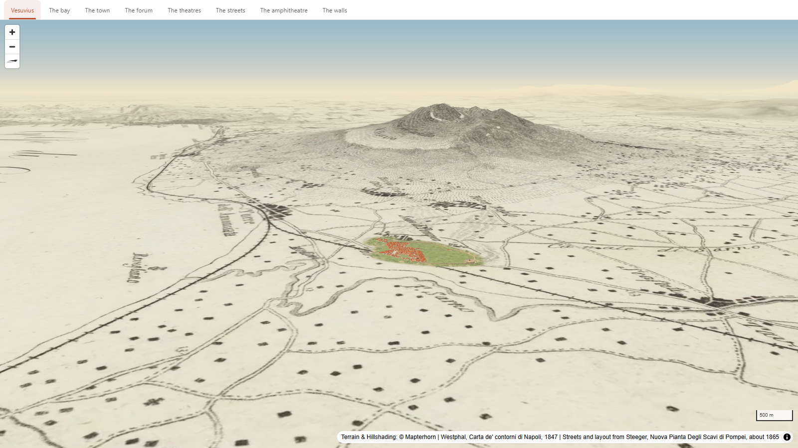
Rather than just putting an old map on the screen, I wanted to see if one could be used to build a town. So this is Pompeii, rebuilt in 3D from a plan drawn around 1865, sitting on an 1847 map of the Bay of Naples, with Vesuvius rising out of the paper on real terrain.
Here's the original plan, Victor Steeger's Nuova Pianta Degli Scavi di Pompei:
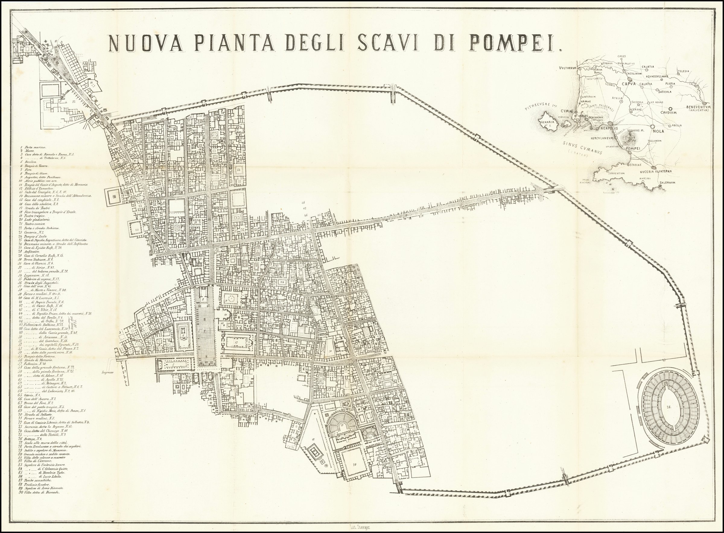
Everything in the 3D town starts from that sheet. The rooms are the spaces enclosed by the plan's wall lines, the pools on the plan become atria, and the rows of dots become colonnades. The big landmarks like the forum, the temples, the theatres and the amphitheatre were modelled individually, using August Mau's 1899 book Pompeii, Its Life and Art as a guide to how they looked.
You can also see how much of the town had been uncovered at the time. The large blank area on the plan is the part that hadn't been excavated by 1865. I didn't want to invent streets that the map doesn't show, so that's simply left as grass inside the walls.
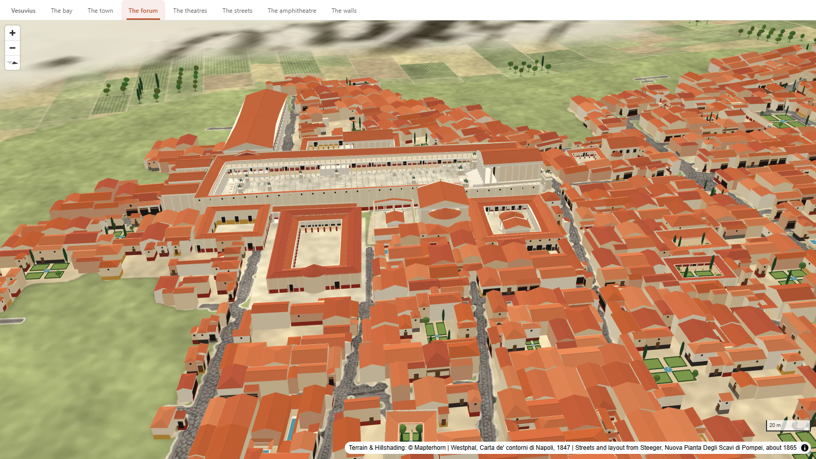
Use the tabs along the top of the map to jump between the bay, the town, the forum, the theatres, the streets, the amphitheatre and the walls.
How did I build it?
For this map I used Icon Map's MCP service, which includes capabilities for generating 3D buildings, so having fed the agent the original maps, it didn't take too many prompts (or tokens) to generate the 3D representation.
How accurate is it?
The layout comes from the plan, but everything above ground is a reconstruction, so please don't treat it as archaeology. Ordinary buildings are generated by rule, not from evidence for each house, and the ground is painted in the style of a museum model. The fields and orchards outside the walls are decorative. Vesuvius is today's terrain, not the mountain as it was in AD 79. The arena floor sits at ground level, the amphitheatre tunnels are only shown as entrances, and the Small Theatre was roofed, but I've left it as a cutaway with bare timbers so you can see inside.
Sources
Plan of Pompeii: Victor Steeger, Nuova Pianta Degli Scavi di Pompei, about 1865. Public domain, via Wikimedia Commons.

Map of the bay: Giovanni Enrico Westphal, Carta de' contorni di Napoli per uso de' forestieri e viaggiatori, 1847. Public domain, via Wikimedia Commons. Source gallica.bnf.fr / BnF.

Landmark details: August Mau, Pompeii, Its Life and Art, translated by Francis W. Kelsey, via Project Gutenberg.
Terrain: © Mapterhorn. Source data includes TINITALY, Istituto Nazionale di Geofisica e Vulcanologia (INGV), CC BY 4.0, and Copernicus GLO-30: DLR e.V. 2010-2014, Airbus Defence and Space GmbH 2014-2018, provided under COPERNICUS by the European Union and ESA.
Positioning the plan: © OpenStreetMap contributors, available under the Open Database License.