

30DayMapChallenge Day 2 and the theme is another classic - Lines.
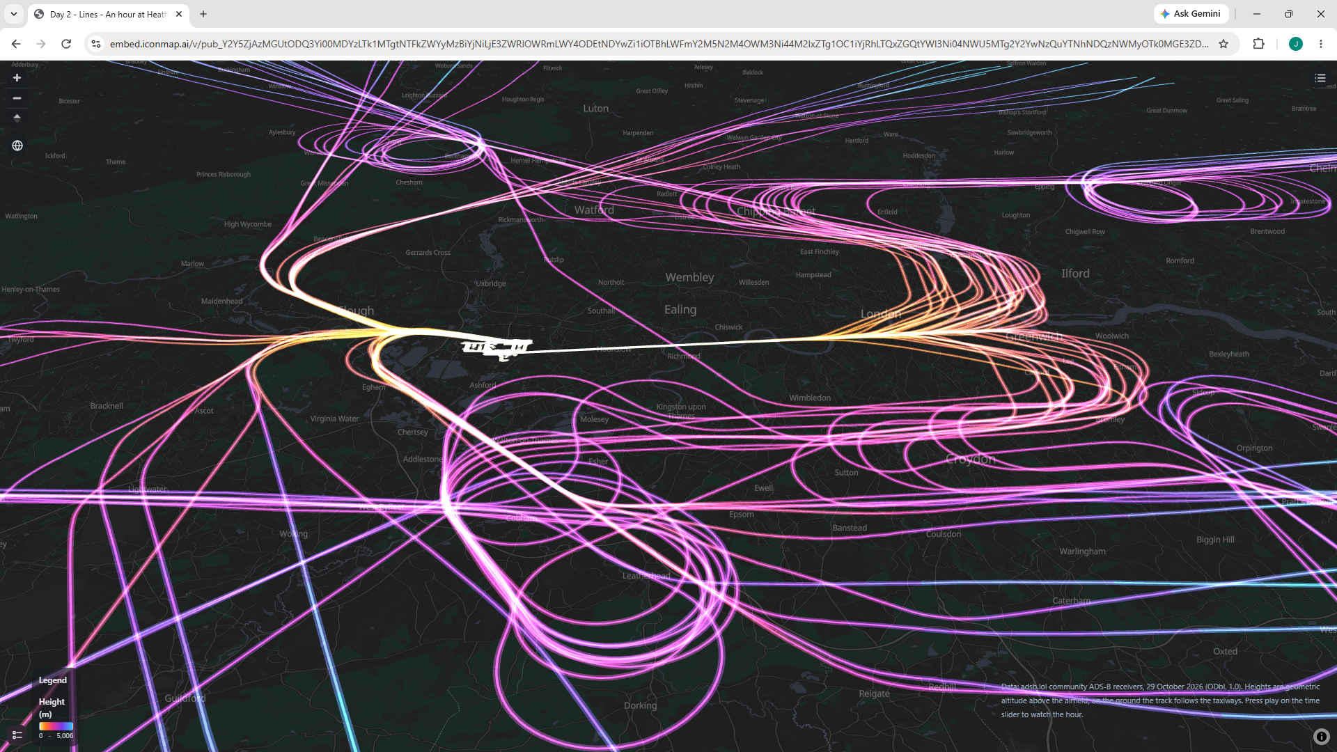
For today's challenge I've collected ADS-B (aircraft transponder) data for an hour between 8am and 9am on the 29th of October around Heathrow airport. I've turned the points into lines to enable us to plot the paths each of the aircraft have taken when coming into land or taking off. Each segment is coloured based on the altitude, and is drawn in 3D space so you can tilt the map, zoom in and see how planes move around the holding patterns, slowly getting lower.
Here's the interactive map to play with