

It's day 18 of the 30 Day Map Challenge, and today's theme is one word: NULL.
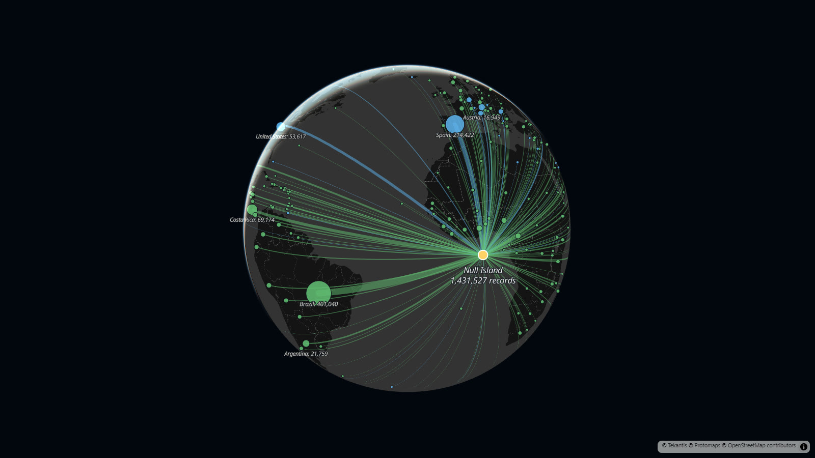
So here is the most biodiverse place on Earth. It has 104,826 species on record. It has rice, redstarts, pumas, English oaks and one polar bear. It's a patch of open sea in the Gulf of Guinea, about 550 km south of the coast of Ghana, and there is nothing there but a weather buoy.
It's called Null Island, and it's at 0 degrees north, 0 degrees east. When a record has no coordinates, a lot of software doesn't store "nothing". It stores zero. And zero, zero is a real place: the point where the equator crosses the prime meridian. Every record that lost its location on the way into a database ends up there.
GBIF is the world's open database of biodiversity: nearly four billion records of where plants and animals have been seen or collected. It checks every record that comes in, and flags the ones at exactly zero, zero. Today there are 1,431,527 of them.
Most of these records still say which country they came from, even though their coordinates are gone. So the map draws each one home. Every line runs from Null Island to a country, and the thicker the line, the more of that country's records are sitting in the sea. Green means they're mostly plants and blue means they're mostly animals. Hover over a country to see how many it has and what they are. Use the bookmarks along the top to move around.
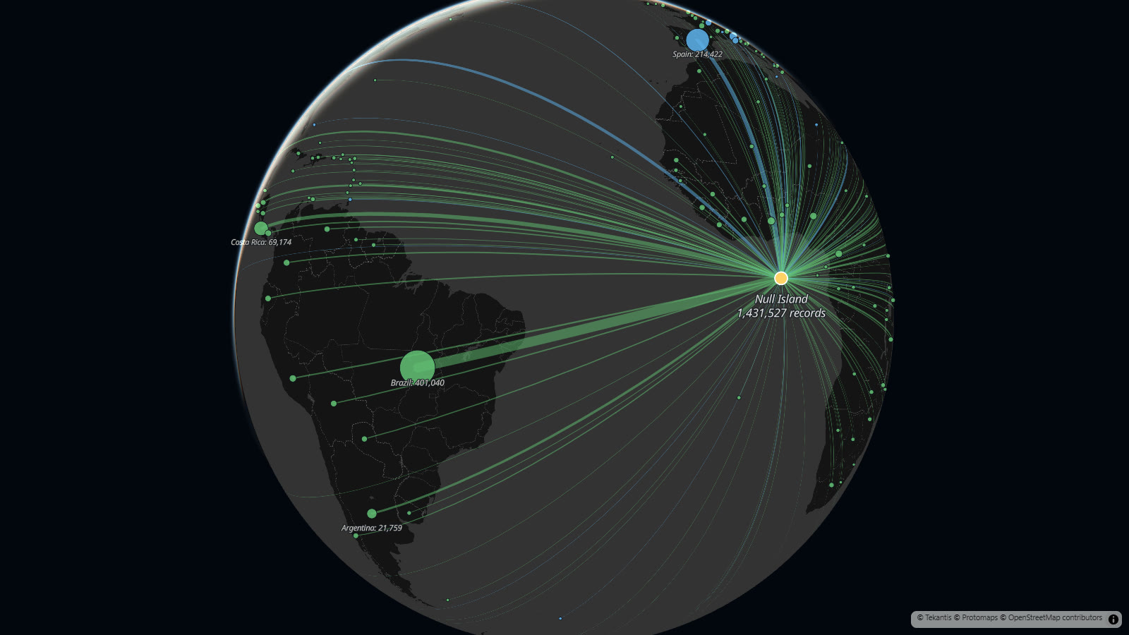
More than a quarter of them are from Brazil: 401,040 records. Nearly all are plants, and most of those are pressed specimens in Brazil's herbaria. A single herbarium in Curitiba accounts for more than 160,000 of them. These are real plants, collected over a century or more, with a label that says where they were found. The label just never became a pair of numbers.
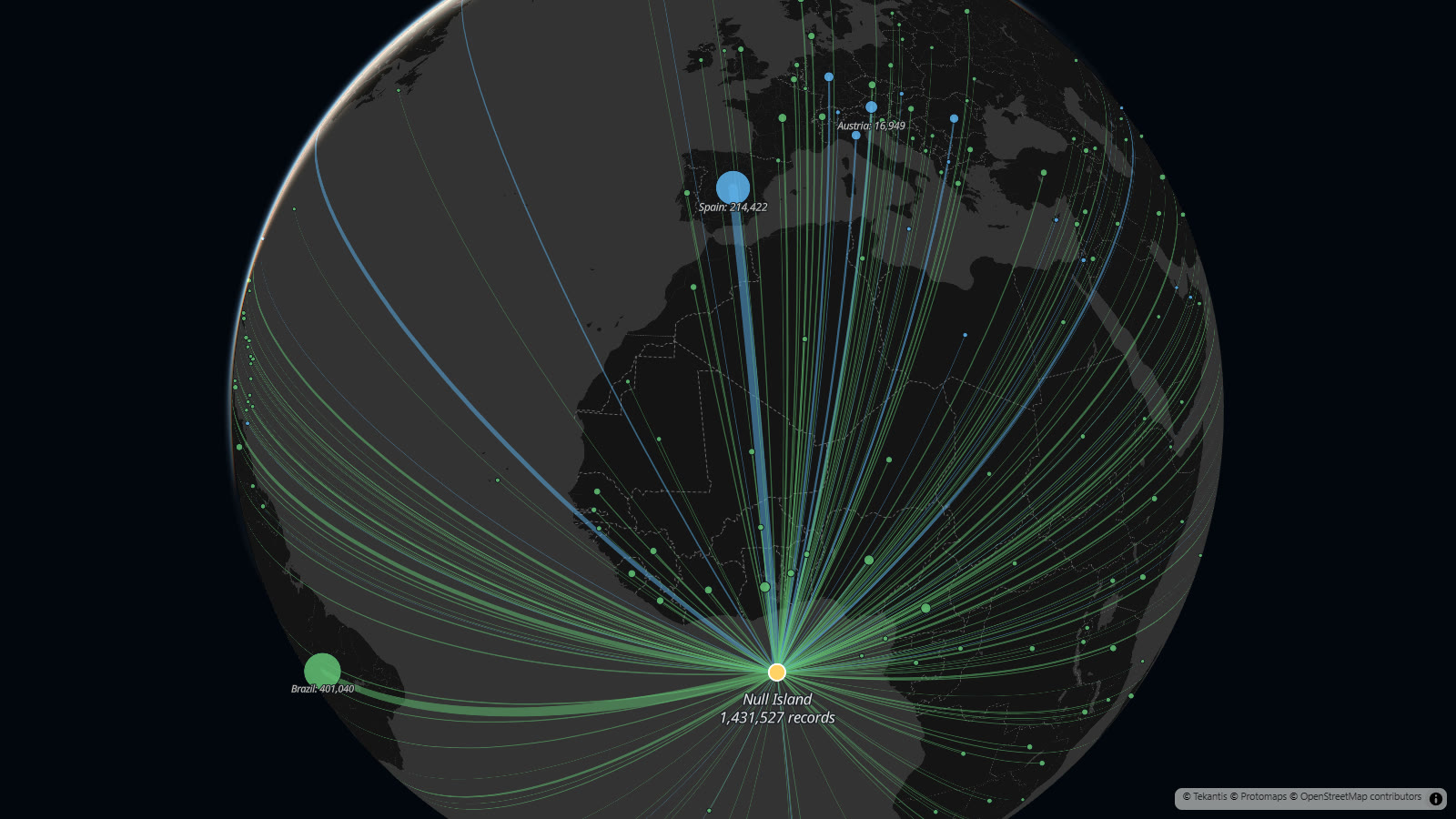
Spain is second with 214,422, and its line is blue. Almost all of them are birds from one bird ringing dataset: birds caught, ringed and released all over Spain and its islands. That's why Audouin's gull and Scopoli's shearwater are two of the most common animals on Null Island.
Then zoom in. The last bookmark flies down to the point itself, where the lines stop and you can see who lives there.
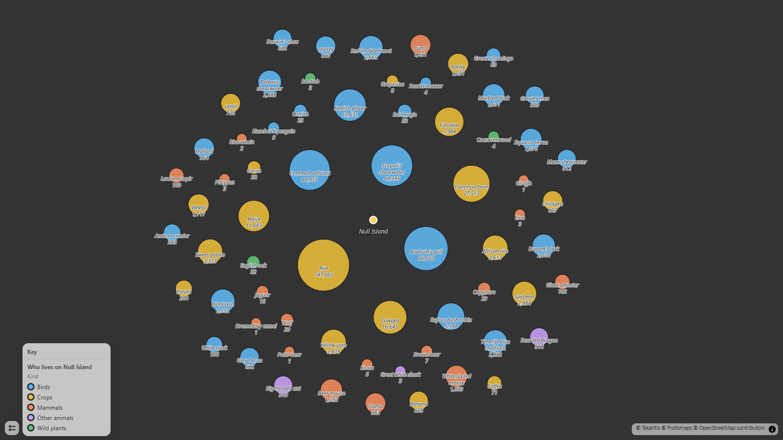
The biggest resident by a long way is rice: 147,065 records. Then beans, cowpeas, maize and cassava. These come from the world's seed banks, where every sample of a crop variety is a record, and a great many of them have no coordinates. So Null Island is also the largest rice field on Earth.
Around the crops are the birds, and then the ones I went looking for. There are 1,051 pumas and 983 llamas. There are 303 Andean condors, 53 bald eagles, 32 English oaks, 8 Humboldt penguins and 6 koalas. There are three lions, three great white sharks, three platypuses, two blue whales, one giraffe, one camel and one polar bear, all sharing a buoy on the equator.
And 282,385 of the records don't have a country either. They have no lines on this map. They really are nowhere.
How did I build it?
I built this one using Icon Map's MCP service. I didn't download the records. GBIF's public API will count records for you, grouped any way you ask, so I asked it for the records flagged as zero coordinates, counted by country, by kind of life and by species. That gives a few small tables: 216 countries with their totals, the species, and the totals for the island itself.
Those tables are stored as files in a Fabric lakehouse. In Icon Map for Fabric the lines are a lines layer drawn as great circles on a globe, from each country to zero, zero, with the width set by the number of records. The countries are a circles layer on top, and the panel on the right is two cards and a bar chart reading the same files.
The close-up is another circles layer that only appears when you zoom in. Each circle is a species, sized in meters on the ground so the picture holds together as you zoom.
How accurate is it?
The counts are GBIF's, taken on 13 November 2026. They change every day as datasets are fixed and new ones arrive.
Not every record at zero, zero is a mistake. Somebody could really have seen a seabird from a ship at that spot. But the giraffe didn't.
The circles around Null Island are a drawing. Every one of those records is at exactly the same point, so I've spread the species out around it to make them visible. Their positions mean nothing.
The size of each species circle is not in proportion to its count. If it were, the rice would cover the polar bear. Bigger still means more, and the number on each circle is the real count.
The names are everyday names I've added for the species shown. The "kinds" in the key are my own rough groups.
Seven small territories with 782 records between them, such as French Guiana and Réunion, are counted in the totals but have no line.
Sources
Biodiversity records: GBIF.org, the Global Biodiversity Information Facility. Occurrence records with the "zero coordinate" flag, counted through the GBIF API on 13 November 2026. The records belong to the many institutions that publish through GBIF.
Country positions: Natural Earth.
Basemap: © Protomaps © OpenStreetMap contributors.