

It's day 15 of the 30 Day Map Challenge, and today's theme is inside out: "Inside out, upside down. Something on this map is not quite right."
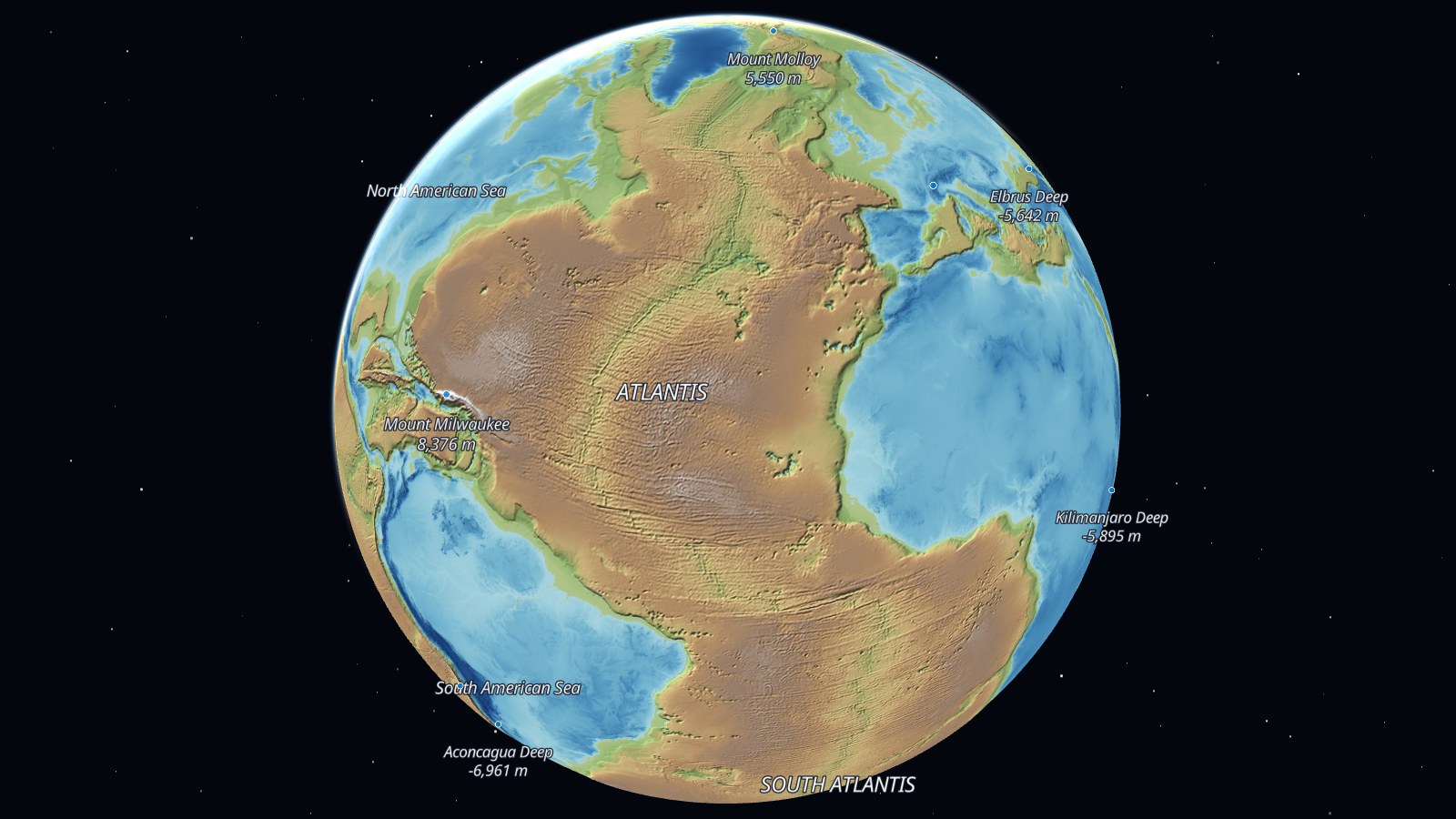
So here is the Earth, inside out. I took the height of every point on the planet and flipped its sign. What was 4,000 m below the sea is now 4,000 m above it, and what was 4,000 m above is now 4,000 m below. Sea level stays where it is, so every coastline is still in the right place. It's just that the land and the water have swapped sides.
The oceans become the continents. The Atlantic is Atlantis, a plateau four to five kilometers high, split down the middle by the rift valley that used to be the Mid-Atlantic Ridge. The Pacific is Pacifica, the largest land on the planet. The old continental shelves, the shallow seas around our coasts, are its green coastal lowlands.
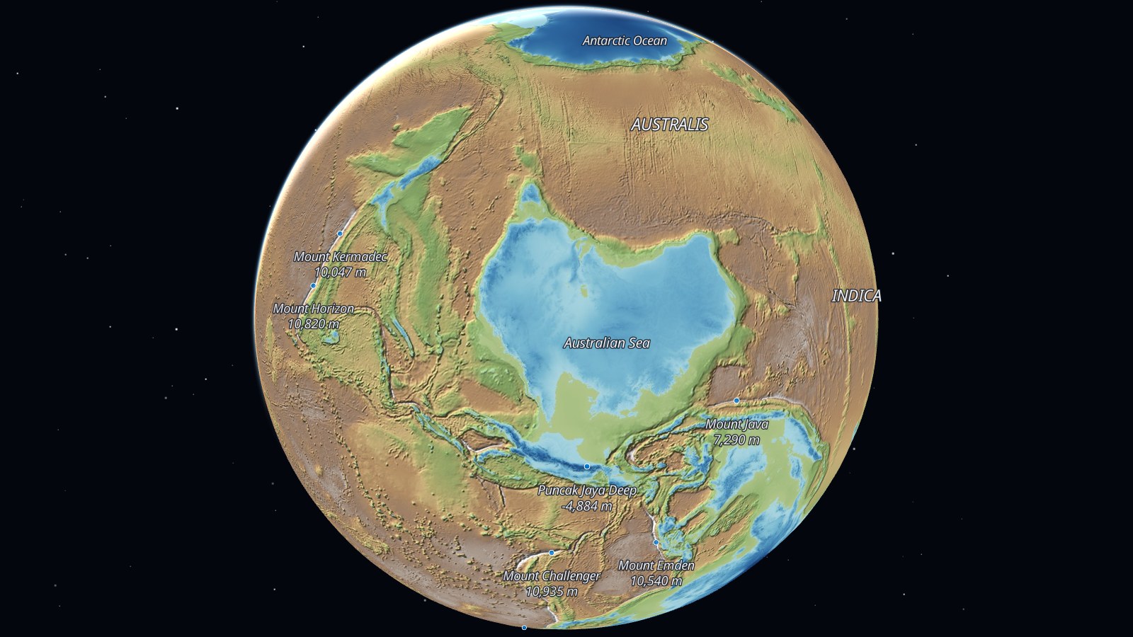
The continents become the seas, and each one keeps its shape. There's a Sea of Africa, a North American Sea, and an Australian Sea, the shallowest of them. The names are all mine.
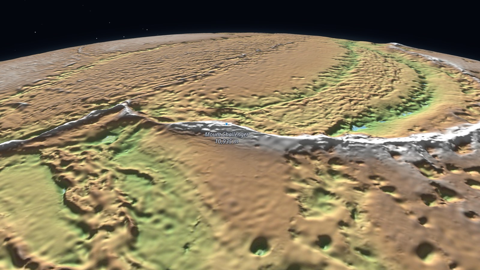
The deepest places in our oceans are the highest mountains of this world. The Challenger Deep in the Mariana Trench, 10,935 m down, is Mount Challenger, the highest point on Earth and more than two kilometers higher than our Everest. The ocean trenches are long and narrow, so they make long, narrow mountain ranges, curving along the edges of the old Pacific.
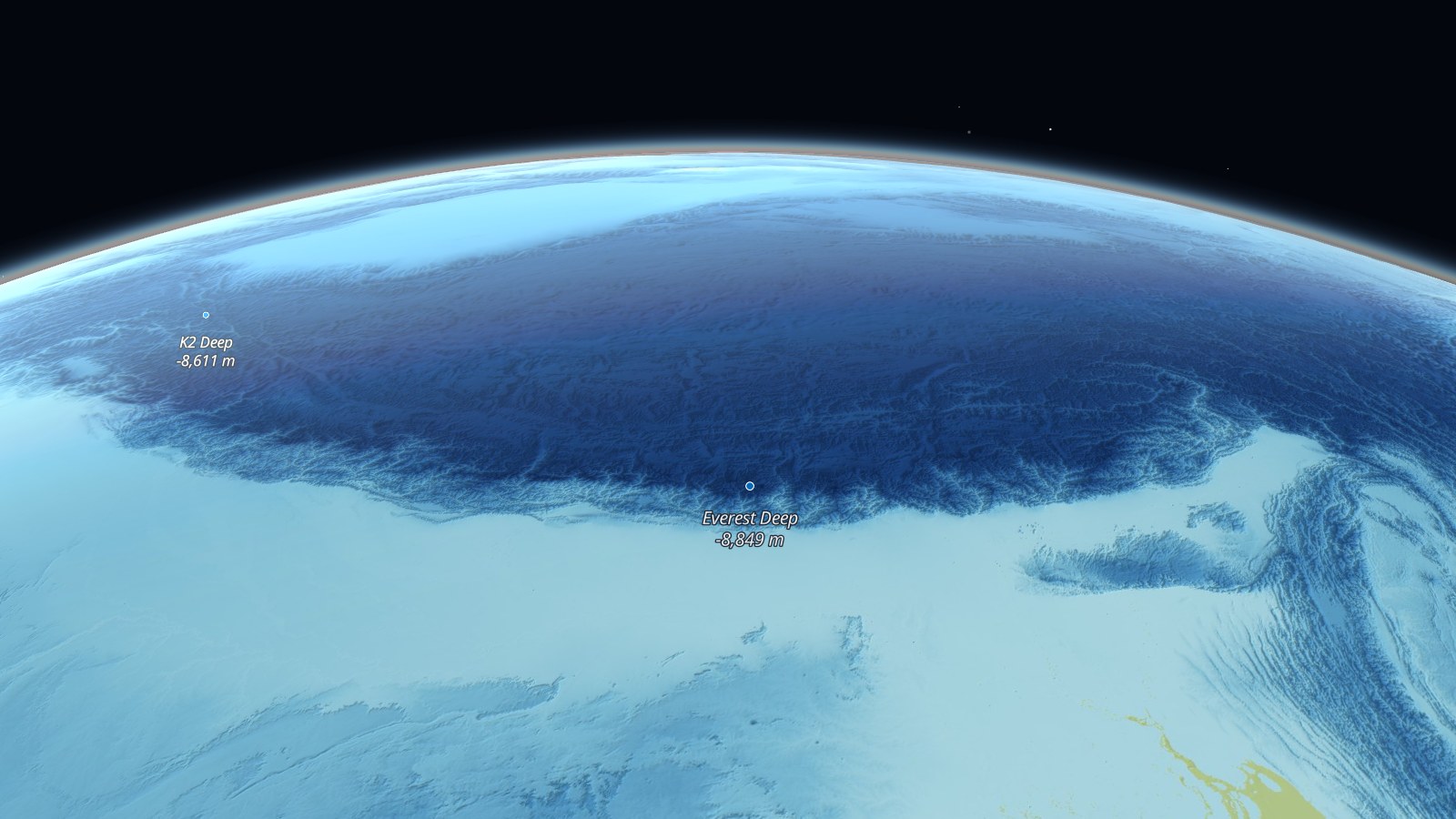
And the highest mountains are the deepest water. Everest is the Everest Deep, 8,849 m down, at the edge of the Tibetan Plateau, which is now the dark floor of the Eurasian Ocean.
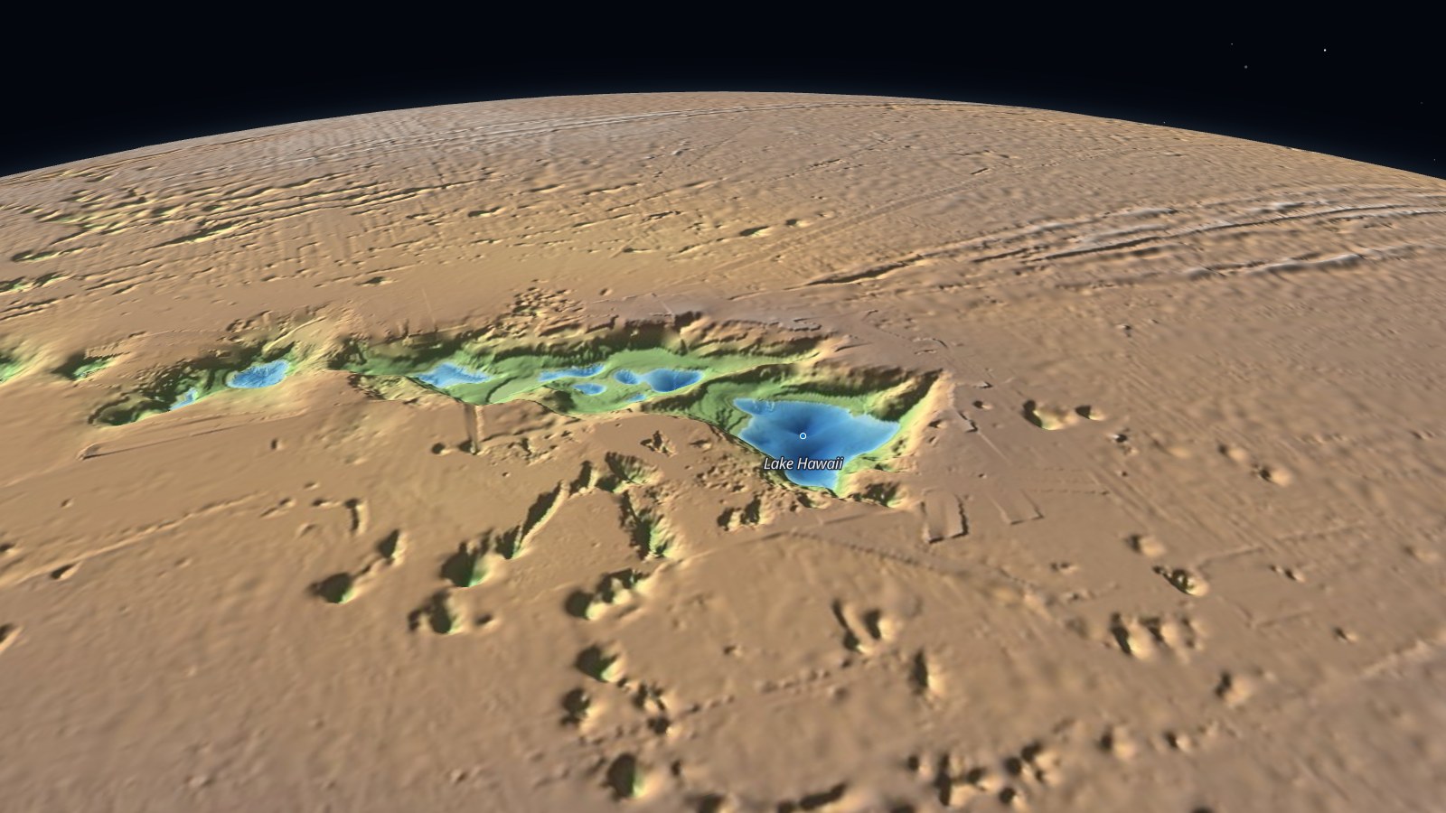
Islands turn into lakes. Hawaii is my favorite: Mauna Kea rises 4,207 m above the sea from an ocean floor five kilometers down, so here it's a lake 4,207 m deep at the bottom of a pit in a plateau five kilometers high. Around it, every seamount on the Pacific floor is a crater.
Closer to home, Europe is drowned and the Mediterranean stands above it as a mountain land. You can still pick out Italy, as a long bay.
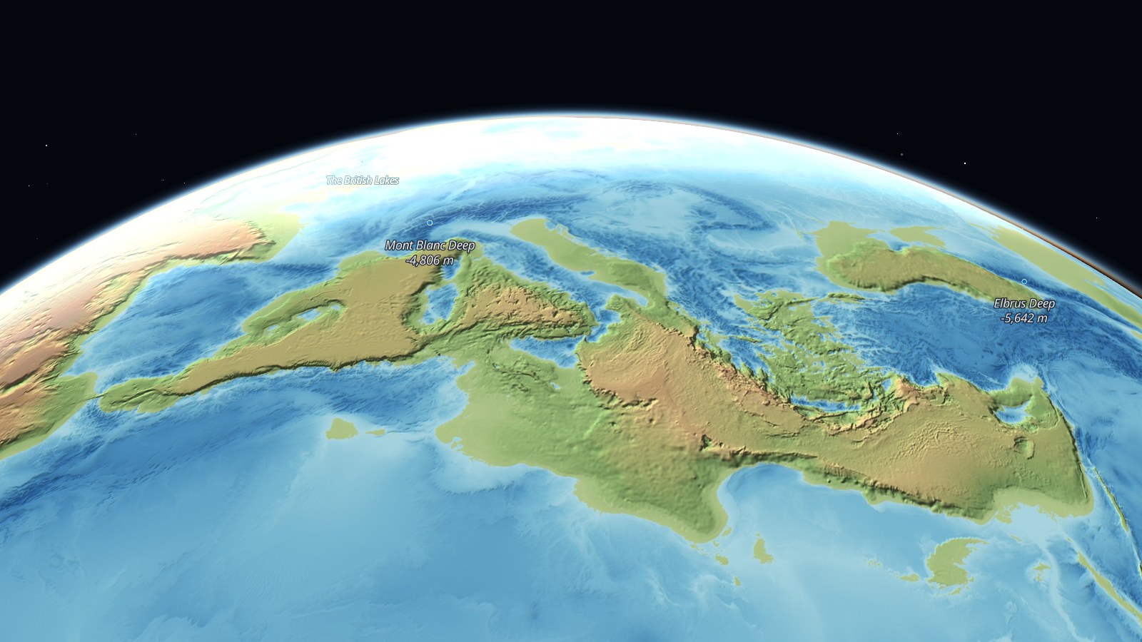
Spin the globe, and use the bookmarks along the top to visit Mount Challenger, the Everest Deep, Atlantis, Lake Hawaii and the Mediterranean Highlands. The terrain is in 3D, so tilt the map (right-click and drag) to see the mountains stand up. Hover over a name to see what it is in our world. The last bookmark is for the other half of the theme: the same planet, upside down, with south at the top.
How did I build it?
I built this one using Icon Map's MCP service. The data is the Terrain Tiles dataset, an open elevation model of the whole planet that includes the depth of the sea floor as well as the height of the land. I downloaded the world at eight zoom levels, 21,845 tiles, and for each one made two new tiles.
The first is the flipped elevation: the same tile with every height negated. Icon Map for Fabric can use any elevation file in OneLake as its 3D terrain, so this one file is what makes the trenches stand up as mountains. The heights are drawn at four times their true scale. At their real scale, even an 11 km mountain is hard to see on a planet 12,742 km across.
The second is the picture draped over it: a shaded relief map, colored by height for the new land and by depth for the new sea, lit from the north-west. It's drawn from the flipped heights, so the shadows fall the right way for the flipped terrain.
Both are stored as PMTiles files in a Fabric lakehouse, and the map reads them straight from there. The names are a small table of 42 places, with the real feature each one stands for and its flipped height.
How accurate is it?
The shapes are real. Every mountain, plateau and basin is a real feature of the Earth, measured, with its height reversed. The coastlines are exact, because zero is still zero.
The detail is coarse. At the most detailed zoom level each pixel covers about a kilometer, and much of the deep ocean floor has only ever been mapped from satellite measurements of the sea surface, which is less detailed still. In the data, Mount Challenger comes out at 10,860 m. The labels use the accepted surveyed figures.
Antarctica and Greenland are flipped from the top of their ice, not from the rock underneath, so the Antarctic Ocean is up to four kilometers deep where the ice sheet is thickest.
And the water wouldn't fit. Our oceans hold more than ten times as much water as the continents have room for above sea level. If you really turned the Earth inside out and poured the oceans back in, they'd fill the new seas and carry on rising, and most of the new land would go under. This map only shows which side of zero each place is on.
Sources
Elevation and ocean depth: Terrain Tiles, by Mapzen, hosted by AWS Open Data. It combines SRTM, GMTED2010, ETOPO1, GEBCO and other open elevation sources. See the dataset's attribution.
Basemap: © Protomaps © OpenStreetMap contributors.
Names: invented for this map.