

It's day 14 of the 30 Day Map Challenge, and today's theme is the Borgesian map.
In 1946 Jorge Luis Borges wrote a story one paragraph long, "On Exactitude in Science". In it, the cartographers of an empire grow dissatisfied with their maps and draw one at a scale of a mile to the mile: a map of the empire the size of the empire, matching it point for point. Later generations find it useless and leave it to the sun and the winters, and its tattered ruins end up sheltering animals and beggars in the deserts of the west.
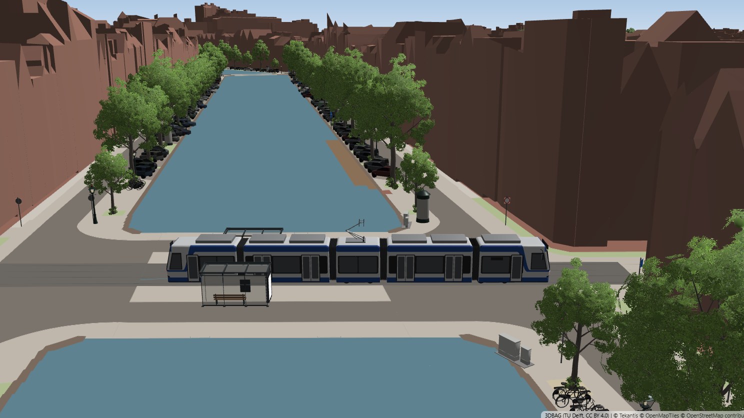
So today's map is one where the map is as detailed as the place. I picked Amsterdam's canal ring, because the Netherlands publishes almost everything about its streets as open data, and tried to draw all of it: every building in its true shape, every surface of the street, and every object standing on it, at its real position, size and heading.
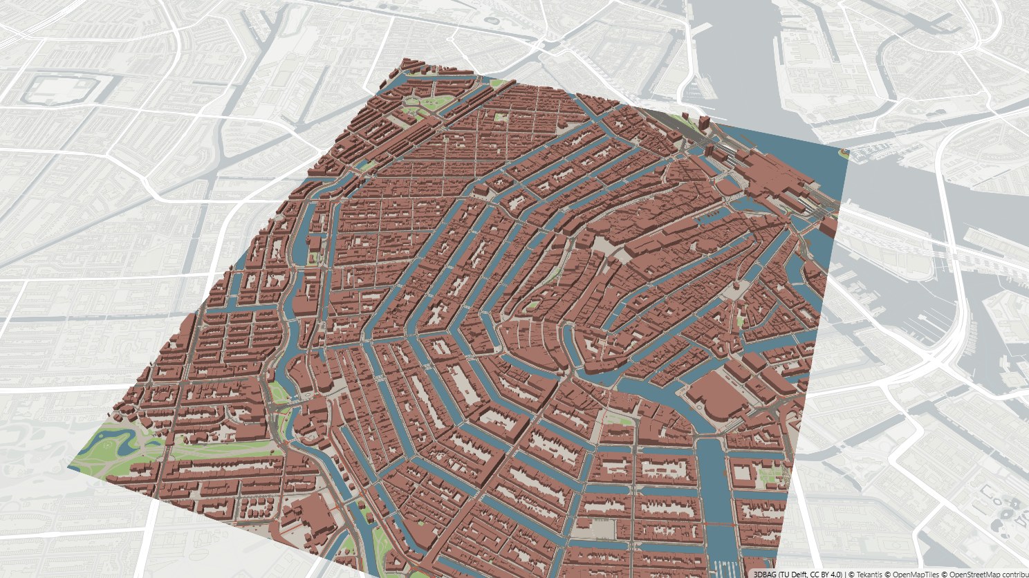
That comes to 15,504 buildings, 45,441 pieces of street surface and 33,773 objects:
- 7,945 trees, more than half of them elms, each drawn as its own species at its recorded height
- 8,811 parked cars in 10,148 parking bays
- 4,780 street lamps, 3,013 of them the canal lanterns with the crown on top
- 1,993 bike racks, 609 benches and 203 Amsterdammertjes, the city's red-brown bollards
- 891 underground waste containers, colored by what goes in them
- 6,688 sign posts carrying 7,661 traffic signs
- 547 houseboats on their berths
- 32 trams at their stops
The bookmarks along the top step down through the map scales, from 1:1,000,000, where Amsterdam is a dot, to 1:1, where you're just above the water of the Keizersgracht, watching a tram cross the bridge, and the map is the same size as the street.
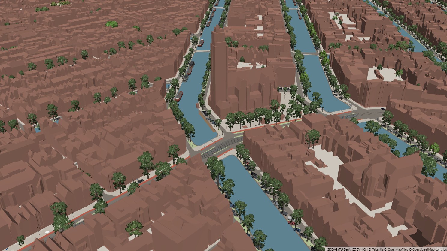
The buildings are the real ones. 3DBAG, from TU Delft, models every building in the Netherlands in 3D, with roof shapes measured from the national height survey. From 1:10,000 down they're simple blocks at their true heights, and as you zoom in the full 3D buildings take over, with their gables, pitched roofs and extensions.
The streets are drawn surface by surface: carriageway, tram track, cycle path, pavement, parking bay, verge, quay wall and bridge deck, each as it's recorded. The tram tracks are drawn as two rails, 1.435 m apart, with the points and crossings where they really are.
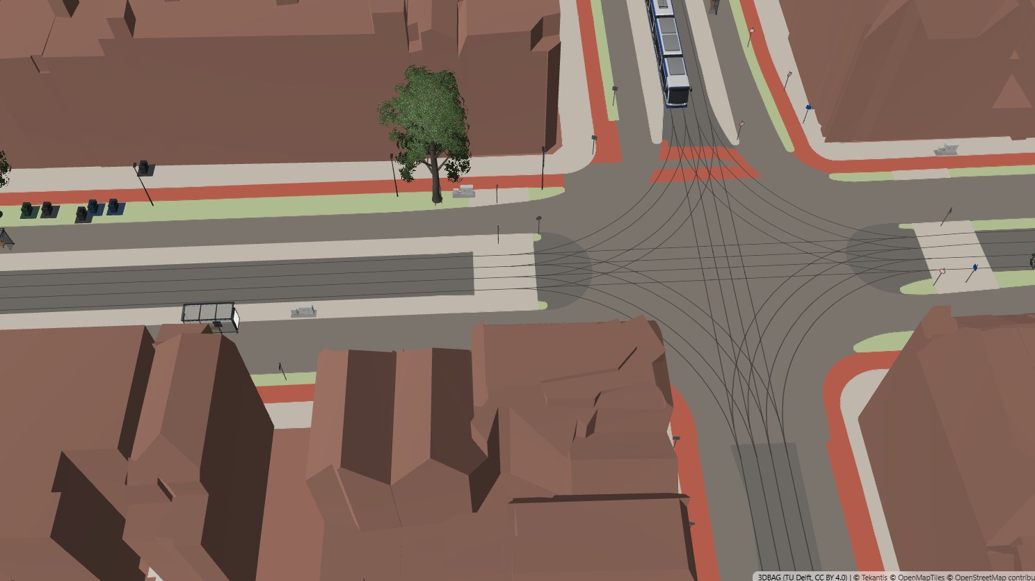
Everything standing on the street is a 3D model from the Icon Map catalog. I built 20 new ones for this map, and they're in the catalog for anyone to use: the canal lantern, the Amsterdammertje, Dutch city bikes and bike racks, the underground waste container, the round advertising column, the curled iron urinal, Dutch sign posts, two kinds of houseboat and a converted barge, a canal tour boat, and two Amsterdam trams.
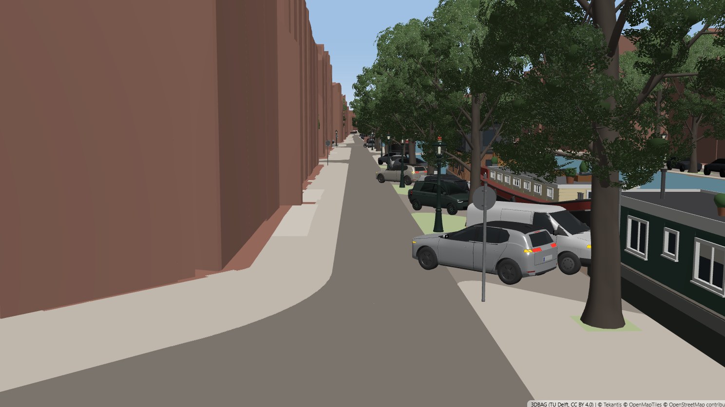
Use the bookmarks to step down the scales, or press play at the bottom to fly through them. Tilt the map (right-click and drag) and hover over anything to see what it is: the surface you're standing on, a tree's species and planting year, a building's height and the year it was built.
How did I build it?
I built this one using Icon Map's MCP service. Every object is a row of open data, placed where the data says it is.
The trees come from the city's tree register, which records each tree's species and height class. Each genus has its own model from the catalog, scaled to the tree's height. The cars are the one thing I made up: the city publishes every parking bay as a polygon, so each bay gets a car parked along its long edge, with about one bay in ten left empty. Taxi stands get taxis, charging bays get electric cars and short bays get small cars.
Lamp posts within 20 m of water are drawn as canal lanterns and the rest as modern street lights. Traffic signs come from the national road sign register, which records each sign's type and the direction it faces. Signs that share a spot share a post. The houseboats come from the register of berths: a long, narrow berth gets a converted barge, a shorter and wider one gets an ark, and each is scaled to the length of its berth.
The trams stand on the track at about six stops in ten. Amsterdam's older trams have a cab at one end and doors on the right side only, so each one faces the way trams run on that track, with its doors to the platform.
Drawing this many 3D models needed some new work in Icon Map for Fabric, all of it released this week. A layer of thousands of models now draws only the ones the camera can see. Models far from the camera are drawn as lighter stand-ins, and I made stand-ins for every tree and car model in the catalog. And Icon Map can now load 3DBAG's 3D Tiles, which cover the whole country in one tileset.
How accurate is it?
The buildings, street surfaces, trees, lamps, signs, berths and parking bays are where the registers say they are. What the registers don't record, the map doesn't show: there are no people, no bicycles outside the racks, no boats under way.
The cars are invented. The bays are real, and so is which way each bay points, but the makes, colors and which bays are empty are not. The same goes for the trams: which stops have one is random.
Each model stands for a type, not an individual. One canal lantern model is every canal lantern, and one elm is every elm, scaled to its height. The building blocks at 1:10,000 have flat roofs at the height 3DBAG measured, which was available for 97% of buildings, and the rest are estimated from their number of storeys. Bridges are drawn as flat decks, not as the brick arches they are.
So it isn't Borges's map. His cartographers would have recorded the bicycles.
Sources
Buildings: 3DBAG by the 3D geoinformation research group, TU Delft (CC BY 4.0).
Street surfaces, tram track, lamp posts, walls and bridges: Basisregistratie Grootschalige Topografie (BGT), Kadaster, via PDOK.
Building footprints and houseboat berths: Basisregistratie Adressen en Gebouwen (BAG), Kadaster, via PDOK.
Trees, parking bays and waste containers: Gemeente Amsterdam open data.
Traffic signs: Nationaal Dataportaal Wegverkeer (NDW).
Benches, bollards, bike racks and tram stops: © OpenStreetMap contributors, available under the Open Database License. Extract from Geofabrik, downloaded 11 November 2026.
Basemap: © OpenMapTiles © OpenStreetMap contributors.
3D models: Tekantis, from the Icon Map catalog.