

It's day 13 of the 30 Day Map Challenge, and today's theme is interactions.
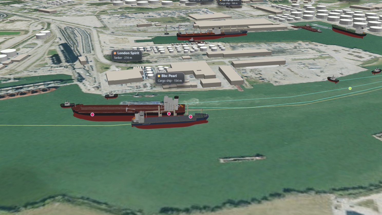
The Houston Ship Channel runs about 50 miles from Galveston Bay up to the Turning Basin in Houston, and it's one of the busiest waterways in the United States. Tankers, container ships and bulk carriers share it with tugs, towboats pushing strings of barges, ferries, fishing boats and pleasure craft. The channel is narrow, so when two big ships meet they pass close. Pilots call it "Texas Chicken": the two ships hold the middle of the channel heading for each other, and late on both turn to starboard and let the water pushed up between their bows ease them apart as they slide past.
I've replayed one day of it, 18 June 2026, from the AIS position reports that ships broadcast. Every vessel is a 3D model drawn at the length and beam it reports, and the time slider plays the day.
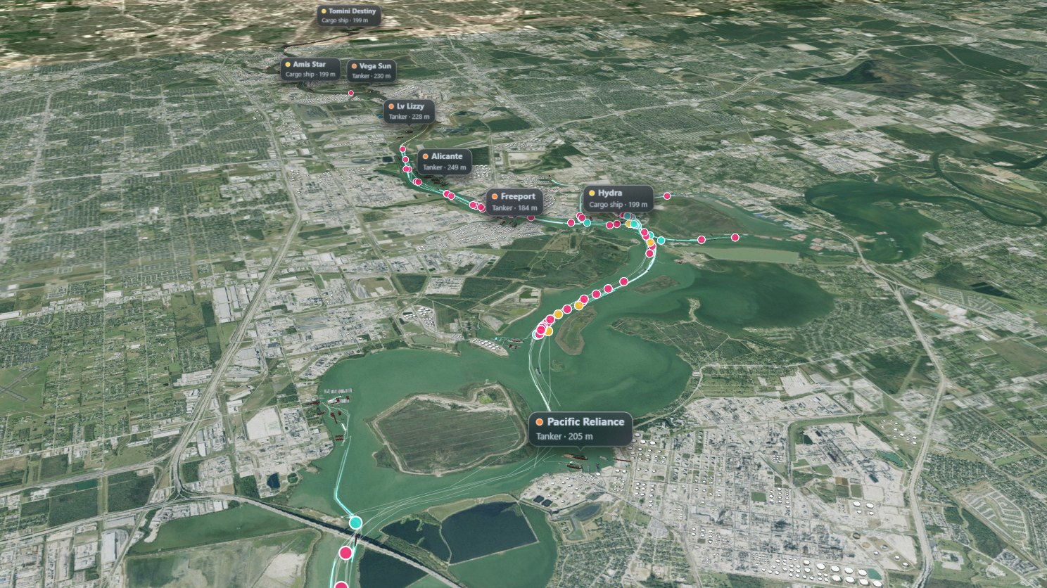
That day, 810 vessels moved on the channel. Two moving vessels came within 250 m of each other 7,446 times: 5,473 head-on, 1,071 overtaking, 824 crossing, and 78 where a tug worked alongside a ship. The lines are the ships' tracks, and the dots are the encounters of the last 20 minutes, pink for head-on, yellow for overtaking, cyan for crossing and green for a tug assist.
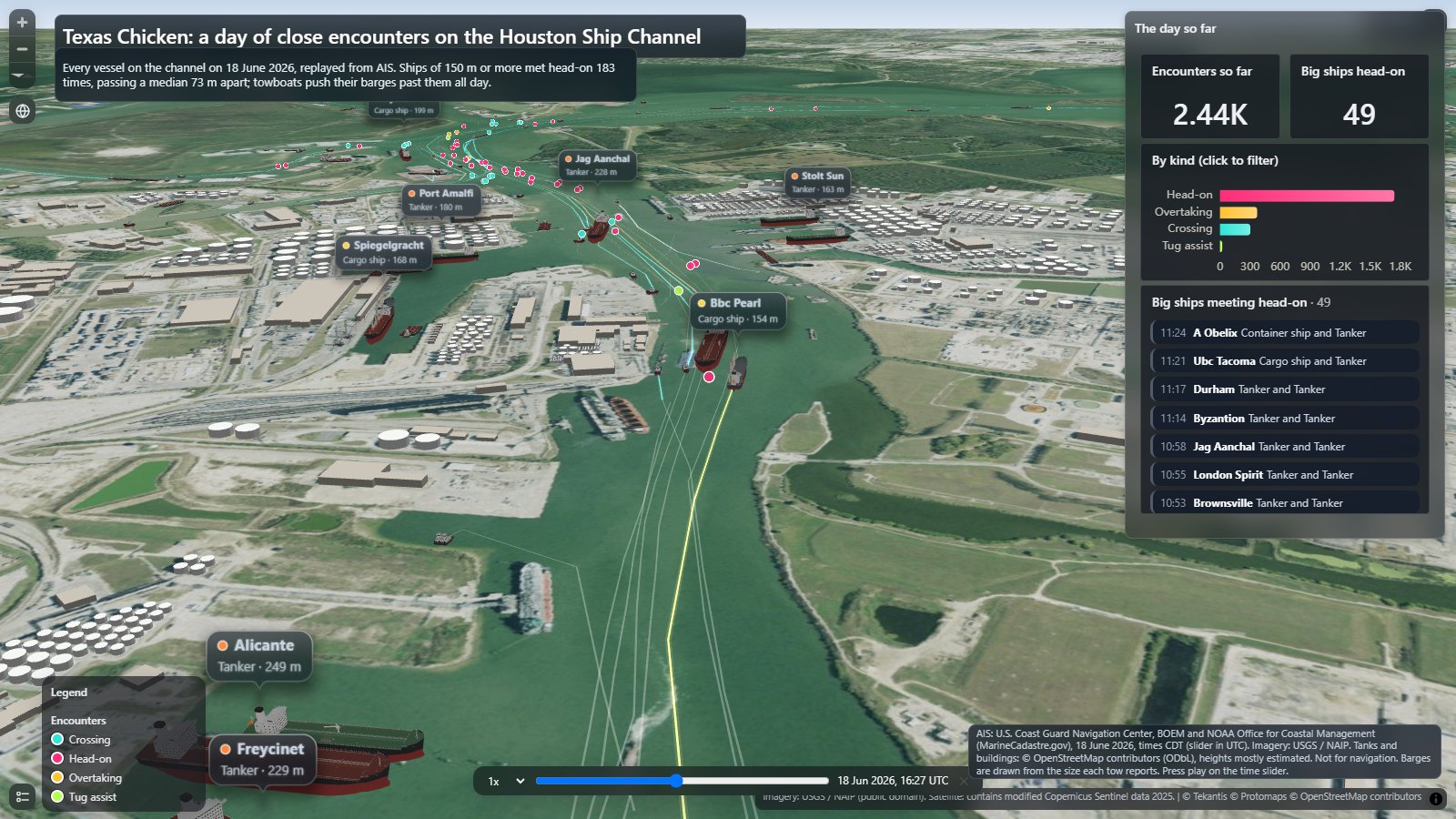
The big ones are the interesting ones. Ships of 150 m or more met head-on 183 times, between 54 ships, passing a median of 73 m apart, hull to hull. Ten of those passes were closer than 30 m, which is inside the accuracy of AIS, so I've described the tightest as "within a few tens of meters".
The bookmarks along the top fly you to three of the closest meetings of the day:
- 11:28: London Spirit, a 274 m tanker, and Bbc Pearl, a 154 m cargo ship
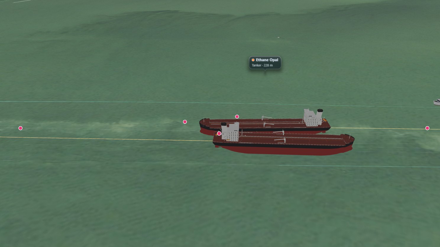
- 13:32: Ethane Opal and Red Rum, two 230 m tankers
- 14:34: Spar Vega, a 189 m cargo ship, and Atlantic Harmony, a 183 m tanker
The panel on the right counts the day's encounters as the slider plays, breaks them down by kind (click a bar to filter the map), and lists every big ship meeting as it happens.
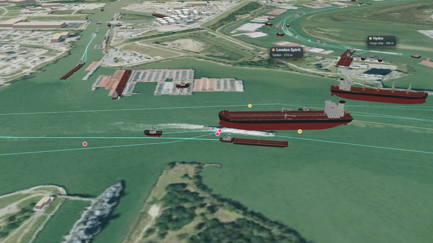
Much of the traffic is towboats. AIS only reports the towboat, but a towboat reports the size of its whole tow, so the map works out how many barges it's pushing from that length and beam, and draws them ahead of it. That's 124 towboats pushing 235 barges. Here London Spirit passes the towboat Thunder and its barge, 51 m apart, with the bulk carrier Hydra behind:
For this map I built a lot of new 3D models and added them to the Icon Map catalog, so they're there for anyone to use: US Gulf Coast towboats, inland tank, hopper and deck barges, an articulated tug-barge, realistic product and Aframax tankers, a geared bulk carrier, Neopanamax and feeder container ships, a multipurpose heavy-lift ship, a harbor tug, and the cranes of a container port.
The cranes stand where they are in the aerial imagery. I went through the imagery berth by berth and placed every crane I could see: 26 ship-to-shore cranes at the Barbours Cut and Bayport container terminals, each with its boom up or down as the photo shows it, 46 yard gantries and 3 mobile harbor cranes. The tank farms and buildings along the channel are 3D too.
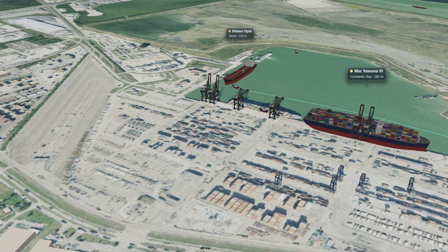
The day plays on its own when the map opens. Use the bookmarks to jump to a meeting, tilt the map (right-click and drag) to see the ships in 3D, and hover over a ship or an encounter to see what it is.
How did I build it?
I built this one using Icon Map's MCP service. The ship positions come from NOAA's national AIS archive, one report a minute from every vessel in US waters. I took every report inside a box around the channel for the day, local time, and resampled each vessel to one position every 30 seconds.
To find the encounters, each vessel is a rectangle of its reported length and beam, turned to its heading. Two vessels, both moving faster than 2 knots, whose rectangles came within 250 m of each other is an encounter, and the gap is measured hull to hull at the closest moment. If the same two vessels meet again within 15 minutes, that's the same encounter. Vessels heading more than 150 degrees apart are head-on, less than 30 degrees apart are overtaking, and anything in between is crossing. A tug that stayed within 60 m of a ship for more than 8 minutes is a tug assist.
The ships are a vehicle tracker layer in Icon Map for Fabric, replaying the day on the map's time slider. Two features are new this week. Fit to size stretches each vessel's model to the length and beam it reports, so one tanker model draws every tanker at its own size. And the time slider can now start playing on its own when a reader opens the map.
Most container ships report themselves in AIS simply as cargo ships, so the map counts a cargo ship as a container ship if it stopped at one of the container terminals that day. Other cargo ships of 175 m or more are drawn as bulk carriers and the smaller ones as heavy-lift cargo ships.
The aerial imagery is the US Geological Survey's NAIP imagery from the Icon Map catalog. The storage tanks and buildings come from OpenStreetMap, drawn in 3D.
How accurate is it?
AIS positions come from each ship's GPS antenna, usually on the bridge, and the map treats them as the middle of the hull, so a hull can be drawn a few tens of meters fore or aft of where it really was. That's why gaps under about 30 m are within a few tens of meters rather than exact figures.
The barges are inferred from the size each tow reports, not reported, so the real tow may be arranged differently, and every barge is drawn as a tank barge because AIS doesn't say what it's carrying. A few tugs and workboats push barges without telling AIS they're towing, and report the size of the whole tow. Those are drawn at their own size, without barges. The ship types are worked out from AIS and size, so a few ships may be drawn as the wrong kind.
The imagery was flown in 2022 or earlier, four years before the AIS day, so the cranes are where they were then. Most storage tanks and buildings have no mapped height in OpenStreetMap, so their heights are estimated from their size and type.
Ship names are shown for commercial vessels only, never for pleasure craft.
Sources
Ship positions: AIS data from the U.S. Coast Guard Navigation Center, the Bureau of Ocean Energy Management and NOAA Office for Coastal Management, via MarineCadastre.gov, 18 June 2026. Not for navigation.
Aerial imagery: USGS National Agriculture Imagery Program (public domain). Zoomed out: contains modified Copernicus Sentinel data 2025.
Storage tanks and buildings: © OpenStreetMap contributors, available under the Open Database License. Extract from Geofabrik, downloaded 11 November 2026.
Basemap: Protomaps © OpenStreetMap contributors.
Ship, barge and crane models: Tekantis, from the Icon Map catalog.