Europe Location Data for Power BI

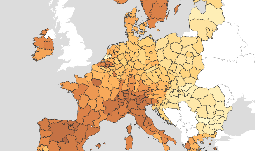
Pan-European boundaries, statistics and infrastructure plus deep coverage for major countries including Ireland, Sweden, Switzerland, Spain and Portugal.

Authoritative European datasets - from NUTS regions to country-level census, transport and environmental layers - all ready to drop into Power BI.

Europe catalog map
328+ layers Authoritative Europe datasets
Cloud native Streamed from the cloud, always up to date
Seamless in Power BI Bind, visualise and filter in seconds

What's in the Europe catalogue?

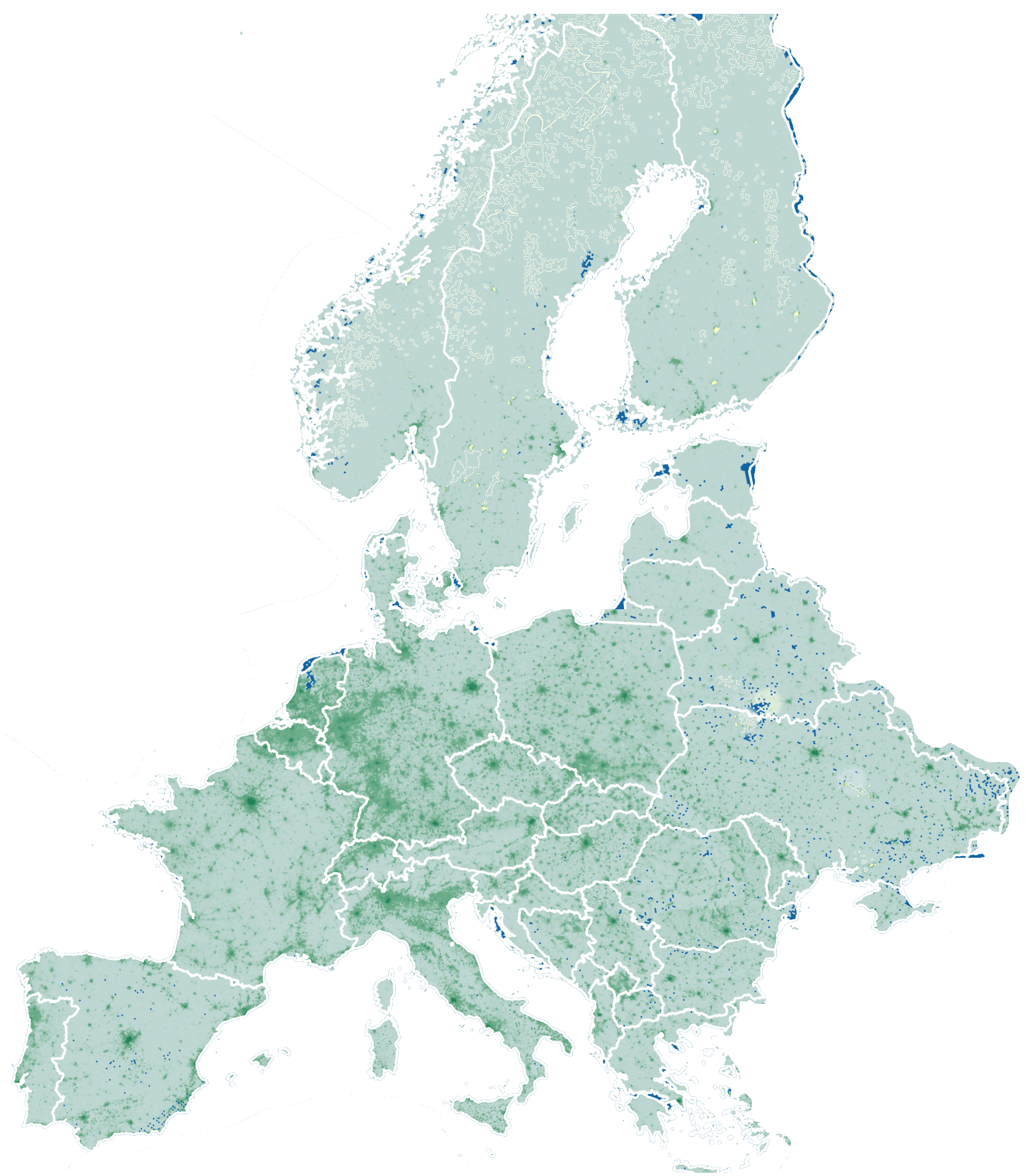
Curated datasets from trusted government and open data sources. All ready to style, filter and bind to your Power BI data.

Administrative & Statistical Geographies

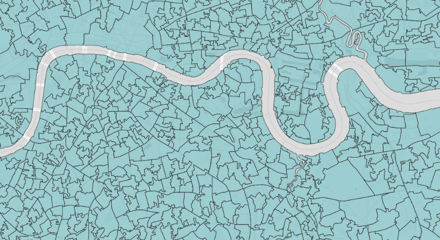
Country, region, county, local authority, census tract and statistical boundaries.

Example layers

  • Belgium - Municipal Districts (Districts / Districten)
  • Germany – District Population (Kreise) 2025
  • Czechia - 2026 - Administrative - Kraje (NUTS 3)
  • Ukraine - Subnational Administrative Boundaries - ukr_admin0
View layers →

Demographics & Population

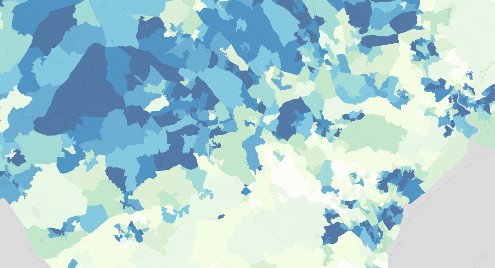
Population counts, age, ethnicity, household composition and census attributes.

Example layers

  • Sweden - Population Grid 1km (Befolkning per 1km-ruta) - 2017
  • Sweden - Population Grid 1km (Befolkning per 1km-ruta) - 2019
  • Sweden - DeSO 2025 - Population by Background
  • Sweden - Population Grid 1km (Befolkning per 1km-ruta) - 2018
View layers →

Economy, Jobs & Business

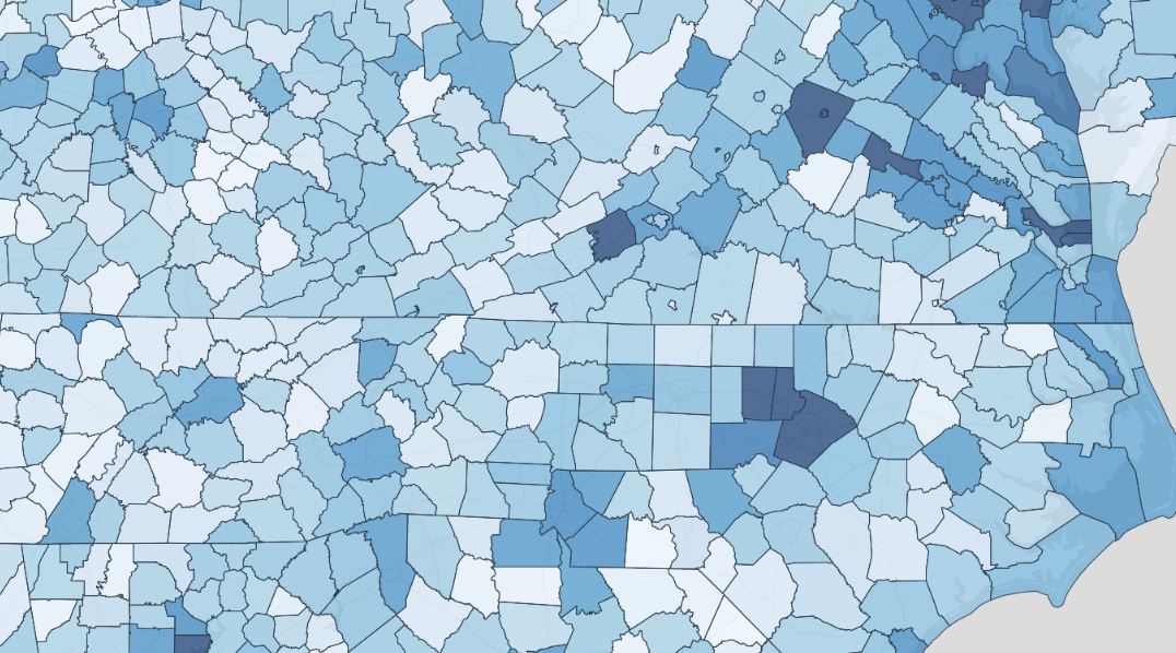
GDP, employment, wages, industry, businesses and consumer markets.

Example layers

  • Sweden - Workplace Areas (Arbetsplatsområden) - 2010
  • Sweden - Retail Trade Areas (Handelsområden) - 2015
  • Sweden - DeSO 2025 - Economic Standard
  • Sweden - Activities Zones (Verksamhetsområden) - 2015
View layers →

Housing, Property & Planning

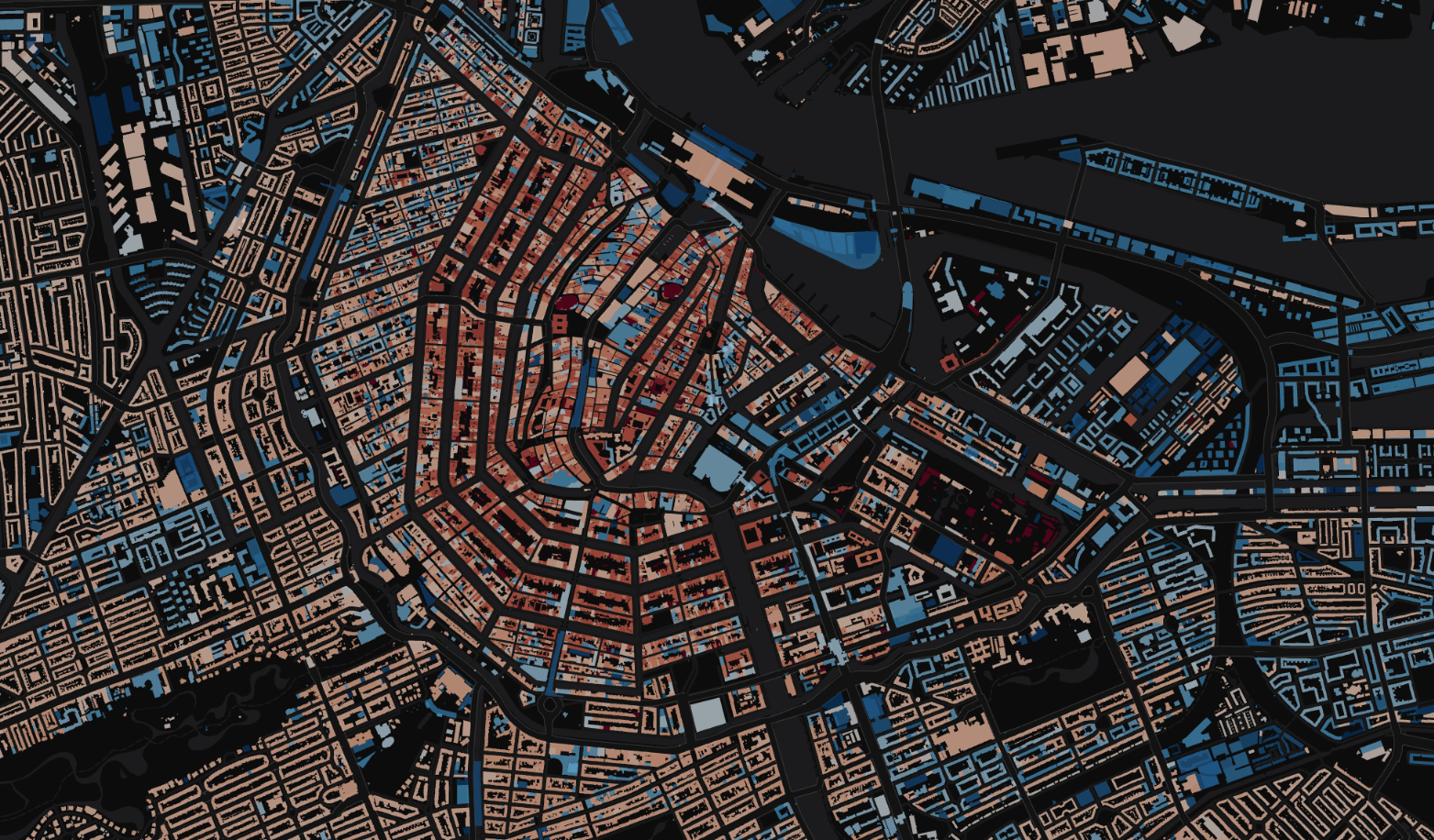
Housing stock, affordability, parcels, building footprints and local planning.

Example layers

  • France - French Cadastre – Sections
  • France - French Cadastre – Parcelles (Land Parcels)
  • France - French Cadastre – Bâtiments (Buildings)
  • Germany – Census Grid 1 km (Zensus 2022)
View layers →

Environment, Nature & Climate

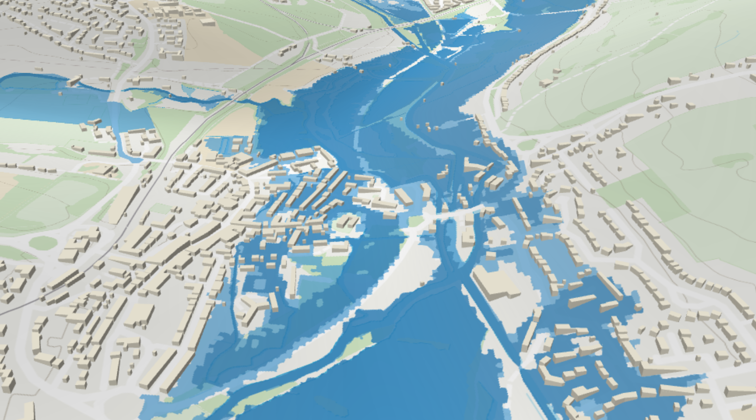
Habitats, ecology, soils, climate, air quality, flood and natural risk.

Example layers

  • Switzerland – swissTLM3D Individual Trees (Einzelbaum)
  • Switzerland – swissTLM3D Protected Areas (Schutzgebiet)
  • Switzerland – swissTLM3D Protective Structures (Verbauung)
  • Switzerland – swissTLM3D Rivers & Streams (Fliessgewässer)
View layers →

Transport, Mobility & Infrastructure

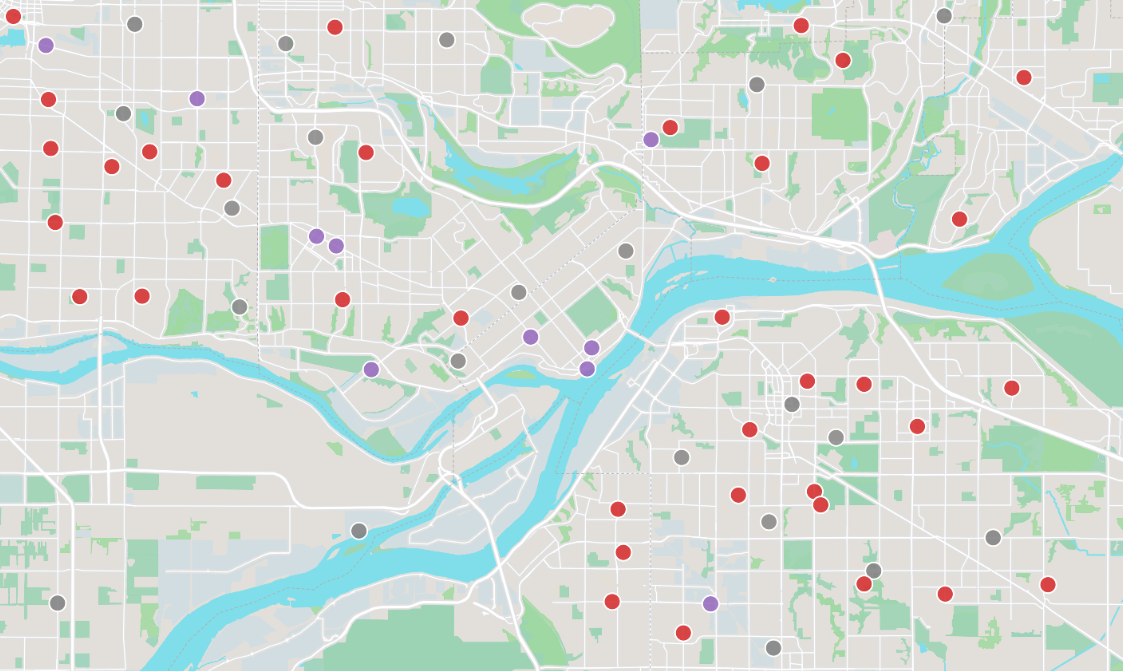
Roads, rail, airports, public transport, EV charging and mobility analytics.

Example layers

  • Switzerland - Railway Network (German)
  • Ireland - Road & Rail Intersections (250K Map)
  • Switzerland – swissTLM3D Highway Entries/Exits (Aus-/Einfahrt)
  • Ireland - Road Interchanges (250K Map)
View layers →

Health & Wellbeing

Healthcare boundaries, public health indicators and care services.

Example layers

  • Europe NUTS 2 – Health (latest + 5y change)
View layers →

Education & Civic

Schools, education attainment, electoral districts and public-sector boundaries.

Example layers

  • Europe NUTS 2 – Education (latest + 5y change)
View layers →

Reference, Basemaps & Place Names

Place names, gazetteers, topography, contours and general reference layers.

Example layers

  • Ireland - Centres of Population - National Placenames Gazetteer
  • Switzerland – swissTLM3D Terrain Names (Geländename)
  • Netherlands - PDOK BRT Achtergrondkaart / Background Map
  • Switzerland – swissTLM3D Walls (Mauer)
View layers →

What can you build?

Real-world analyses you can power with Europe catalog layers in Power BI.

Market & Territory Planning

Understand your markets, customers and opportunities at any geography.

Site Selection & Expansion

Find the right locations using demographics, economic and infrastructure data.

Risk & Resilience Analysis

Assess environmental, health and climate risks to protect people and assets.

Mobility & Accessibility

Analyse movement patterns and accessibility to services and infrastructure.

Program & Policy Impact

Target programs, measure impact and drive better outcomes for communities.