Icon Map
Usage & Instructions
This section provides instructions and guidance on how to use the various features of Icon Map. The ambition is to include a video and downloadable example for each scenario.
Images
Contents
- Images
- Base64 encoded images
- SVG Images
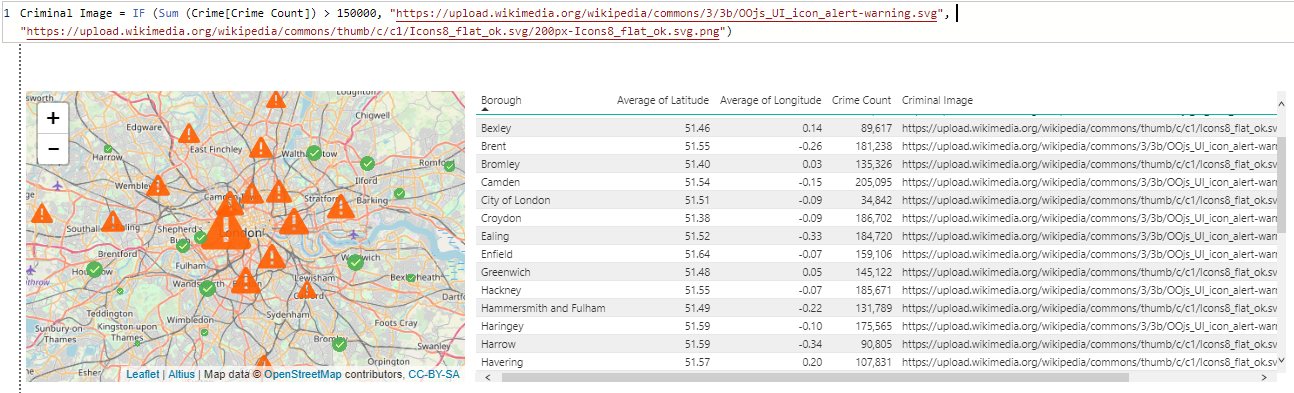
In order to draw images on the map, the URL to the image must be supplied in the Icon URL / WKT / SVG field. This image may be a calculated column, a text field in your data or a measure that returns a URL as an item of text.
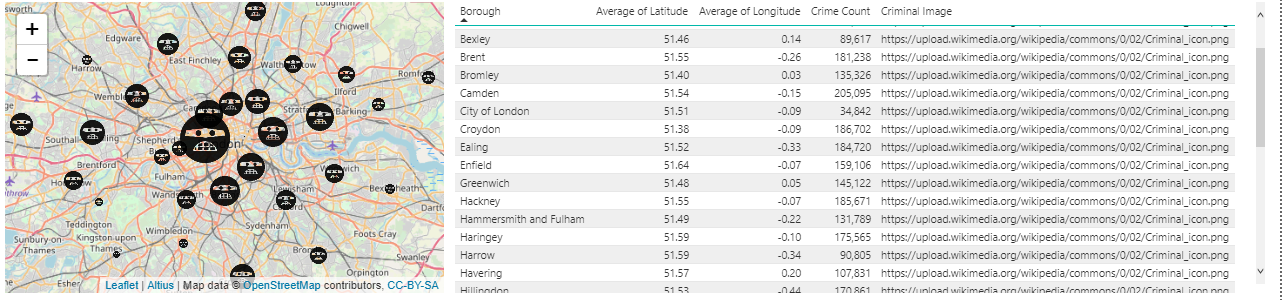
It is possible to have all the images the same as above, or each item showing a different image:
The size of the image will be drawn between the minimum and maximum sizes set in the Data Point settings of the map. Within the Data Point settings, if you switch “Use Min and Max Size fields for Image Size” to Off, then the images will use the Size field as the number of pixels to use for the image width and height. All images are assumed to be square, so the size will be applied to both the width and height of the image.
Tip: If your images do not appear on the map, then check the minimum size field is of a sufficient size to show on the map. The default minimum size is 1, so if all your data has size 1, the images will be too small to see!
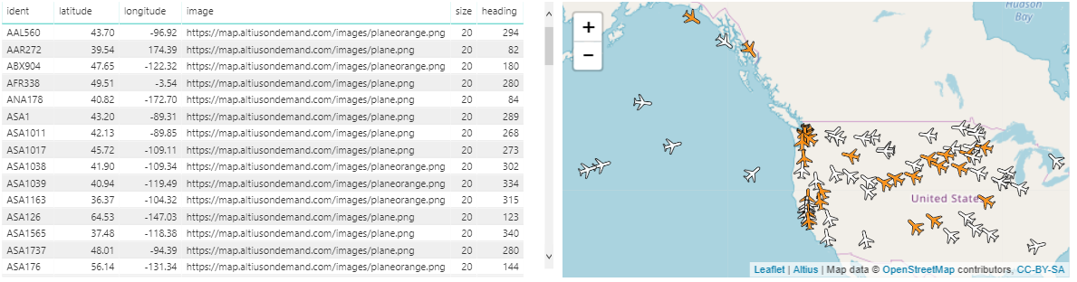
It is possible to rotate an image. For example, a vehicle on a map can be pointing in the direction of travel. The rotation field represents the number of degrees to rotate the image.
Base64 encoded images
If you need to include the image within the report, rather than referencing an external URL, then it is possible to encode your image as a base 64 string. There are many online tools (such as https://www.base64-image.de) that will covert images to this format.
The following DAX creates a measure storing the plane icon, which can be used in the Image / WKT / SVG field
Plane Image = "data:image/png;base64,iVBORw0KGgoAAAANSUhEUgAAAB4AAAAeCAYAAAA7MK6iAAAAAXNSR0IArs4c6QAAAARnQU1BAACxjwv8YQUAAAAJcEhZcwAADsMAAA7DAcdvqGQAAAAYdEVYdFNvZnR3YXJlAHBhaW50Lm5ldCA0LjEuNv1OCegAAAJ8SURBVEhL7ZY/aBNxFMfvNLEJWLUGSUIKpdY/2LooFDUSiJnEpo0odDGgXVwSi4Ogg4UOHWoHo5EWQYlVx4qDSytYxbWIKE6BDlpx0KEqxarV3PP7vbscSbmWNOnpYL/wgZffe+/7JT+SS5QqdQq8N2H9V3R86yaP9jIbF8KaZ0bLWb14duWYyKCi83yoQ3hmtJyTCn7N3u2wglnj7KfZc0zrgHy9d9QKZo2zgtlzTGvBa8GO6f8L3gXsgvnYZM8RdXlcypdb56OiZbZYwax5xh5njNHV0Xow0FBfp+UzYStwMexhhlc+AGq+dh+YaG1plLmRNtvAUjjDWe6Yu1Vpv9elvL3UvU9+Z4O2QXZwljvcpYdhVbl6vG7l+9P+Q7bmlTDZHxZ4zNPLsFxedeBmwFcvH260lxkVrm+TqUxckrEd8mN4p3XOmmfscaZ0hx70oqfpbavGjRuUqWS0SeZyEWv528geGb1wpGiQB0t9nfKc4Sx3in160ZPezABl4o/49LWzB/Thwv2IvBnulHRXG69rAb0xEAP8hNsF89PMHmfGuHMusVf3oBfn6I3eNCj7w+AH8vrxHe1RX0yaQz4OzYA+EARFVfrk4g53Z+hFz1cTOd4KZ5llaTcQVVVpMA4SwAUWa6WPTHrQa9z05iyzLPHtnwAt+qultdLgUtGbGVWpluCa9E+C2xu8ymR4u0fmc4etYNY8Y48zxujqKAQeut1u7cFFI3Bh9KC8u92pw5pn7HGGs6CJi7XqaiAQkHQ6rfWeTsiZaEg2e1Ve7yfwkXUyEpRUMi6pVErz+/3sZblYqy6DWcCrHALdoBkUxXd3EgyCJ+Az4M4yUpQ/695U2dxJnikAAAAASUVORK5CYII="
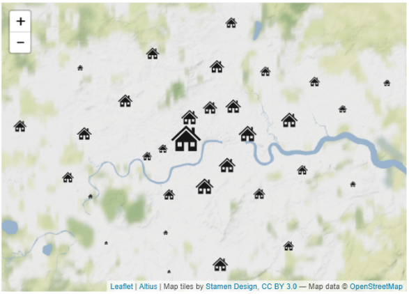
SVG Images
Icon map natively supports Scalable Vector Graphics (SVG). The advantage of using SVG images on the map over raster formats such as PNG or JPEG, is that they will not become pixelated when they are increased in size.
The house in this example is represented by the following measure:
House =
"<svg viewBox='0 0 96 96' xmlns='http://www.w3.org/2000/svg' xmlns:xlink='http://www.w3.org/1999/xlink' id='Icons_House' overflow='hidden'>
<path d='M72 34.8 72 18 64 18 64 27.2 48 12 48 12 6 52 10.5 55.8 48 20.2 48 20.2 85.5 55.8 90 52Z' />
<path d='M18 54.3 18 84 42 84 42 59 54 59 54 84 78 84 78 54.3 48 25.8 18 54.3ZM36 71 24 71 24 59 36 59 36 71ZM60 59 72 59 72 71 60 71 60 59Z' />
</svg>"