
Icon Map
Usage & Instructions
This section provides instructions and guidance on how to use the various features of Icon Map. The ambition is to include a video and downloadable example for each scenario.
Lines
Icon map will draw a line between two points on the map specified by the Longitude and Latitude fields and the Destination Longitude and Latitude fields. In addition to these points the Category and Size fields must also be populated.
(Note it is also possible to draw a line with multiple points using the WKT functionality and the MULTILINESTRING object).
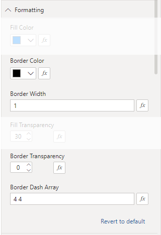
It is possible to set the color of the line, the width, transparency and dash array (whether solid or a pattern) using the formatting settings:
There are also a number of settings in the "Objects" pane that are relevant to lines:
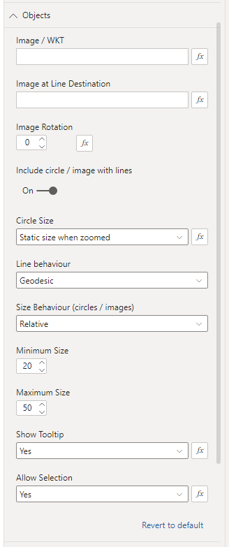
By default a circle is drawn at the origin of the line. These can be removed by changing the "Include circle / image with lines" object to "Off". The circle can be substituted for an image by entering the URL of an image in the "Image / WKT" field. (See here for more info on images). It is also possible to add an image at the destination of the line by adding a URL in the "Image at Line Destination" box. Lines can either be straight set to be curved by selecting "Geodesic" in the "Line behaviour" dropdown.